Activity: Trekking
Annapurna Base Camp Trek
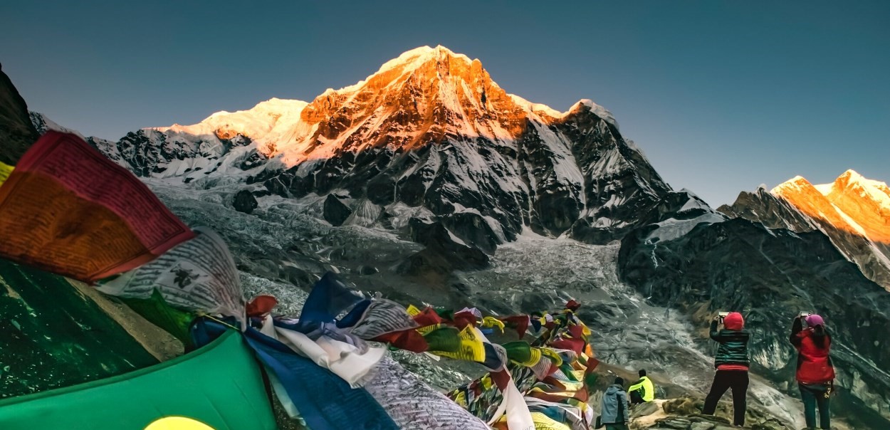
Overview of the Annapurna Base Camp Trek
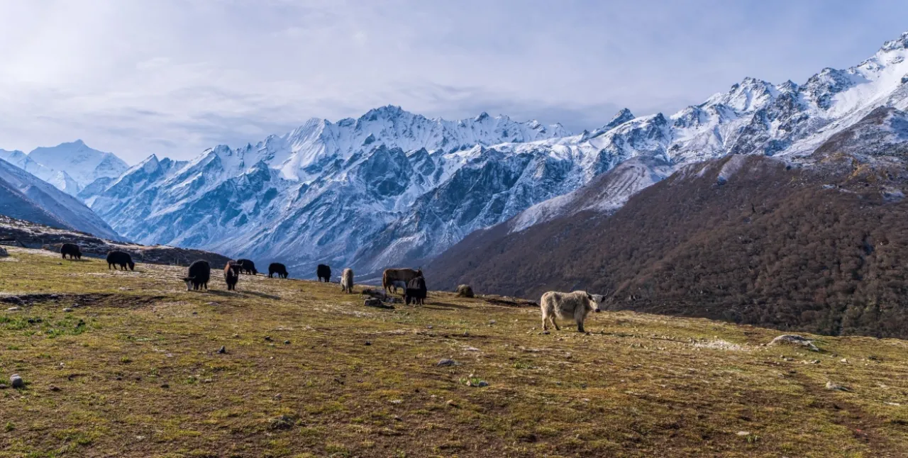
The Annapurna Base Camp (ABC) Trek is one of Nepal’s most iconic Himalayan journeys, offering a rare combination of accessibility, cultural richness, and dramatic mountain scenery. First opened to trekkers in 1949, it remains a top choice for those seeking a rewarding adventure without the extremes of high-altitude expeditions.
Ideal for beginners with good fitness as well as seasoned trekkers, it delivers breathtaking views without the extremes of high-altitude expeditions. The trek takes you through a spectacular mix of landscapes: from lush terraced farmlands and traditional villages to alpine forests and glacial valleys.
The sense of awe, accomplishment, and connection to both nature and local culture make the ABC trek an experience you’ll never forget. Every step brings a new view, a new village, and a new story, blending adventure, scenery, and culture seamlessly.
Quick Details: Annapurna Base Camp Trek
- Location: Nepal, in the north region of Pokhara
- Distance: ~110 km (round trip, depending on route)
- Difficulty: Moderate. Suitable for beginners with good fitness and experienced trekkers
- Cost: $700–$1,500 (includes guide, permits, and accommodation options; budget to mid-range)
- Best Time to Trek: It can start from March and end around May, then in the fall from mid-October till mid-December
- Trail Type: Well-marked trekking paths with suspension bridges, forests, villages, and alpine terrain
Annapurna Base Camp Trek Itinerary Summary (13 Days)
- Day 1–2: Arrival in Kathmandu + cultural sightseeing tour
- Day 3–4: Fly to Pokhara → trek through Ulleri to Ghorepani
- Day 5: Sunrise hike to Poon Hill → trek to Tadapani
- Day 6–7: Trek through Chhomrong and bamboo forests to Deorali
- Day 8–9: Reach Machhapuchhare Base Camp → Annapurna Base Camp (4,130m)
- Day 10–11: Descend via Sinuwa and Ghandruk → drive to Pokhara
- Day 12–13: Return to Kathmandu → departure
Cost for the Annapurna Base Camp Trek
Knowing the cost upfront helps you budget wisely and pick the experience that fits your style. We will ensure that all expenses, including permits, accommodation, meals, and transportation, are covered. This is also based on the current 2026 trekking packages’ trend from other reputable Nepali operators, average international traveler expectations, and standard inclusions.
Average Cost for International Travelers (USD)
| Package | Accommodation | Meals | Guide | Transport | Permits & Extras | Estimated Cost (USD) |
| Premium | 5-star in Kathmandu, 4-star in Pokhara, attached bathrooms along the trek, where available | Breakfast, lunch, dinner + afternoon tea and light snacks | Senior trekking guide | Private 4WD (4 participants) | Hot water bag from 4,000m, duffel & sleeping bag, ACAP & TIMS permits | $1,400–$1,500+ |
| Standard | 4-star in Kathmandu and Pokhara, with attached bathrooms where available | Breakfast, lunch, dinner | Senior/Junior trekking guide | Private 4WD (4 participants) | ACAP & TIMS permits | $1,000–$1,300 |
| Economic / Budget | Non-star accommodation in Kathmandu, basic lodges along the trek (shared bathrooms) | Set-menu breakfast, lunch, dinner | Junior trekking guide | Shared transport | ACAP & TIMS permits | $700–$900 |
Cost Breakdown
- Permits: $30–$50 (ACAP and TIMS)
- Guide/Porter: $15–$25/day for a guide; $10–$15/day for a porter
- Accommodation: $5–$20/night for budget; $20–$40/night mid-range; premium depends on package
- Food: $5–$15 per meal along the trail; premium packages include full menu + snacks
- Transport: $10–$40 for flights or local transfers; private vehicle included in standard/premium
Things to Consider for Annapurna Base Camp Trek
Before you set out on the Annapurna Base Camp trek, it’s important to be aware of a few key factors that can affect your experience:
- Trail Disruptions: Some sections of the trail are impacted by ongoing road and construction work. While most jeep trails are avoided, a few stretches are unavoidable.
- Seasonal Crowds: The peak trekking months (April, October–December) bring heavy traffic to the trails. Expect busy tea houses and popular viewpoints during these periods.
- Limited Lodging: High-altitude villages within the Annapurna Conservation Area have limited accommodation. During peak season, shared rooms with 3–4 people are common.
- Weather Dependency: Weather in the Himalayas can change rapidly, even during ideal trekking seasons. Be prepared for sudden temperature drops or rain.
- Winter Challenges: Snow, ice, and potential avalanches can make certain trail sections impassable during early spring and winter months. Proper gear and local guidance are essential.
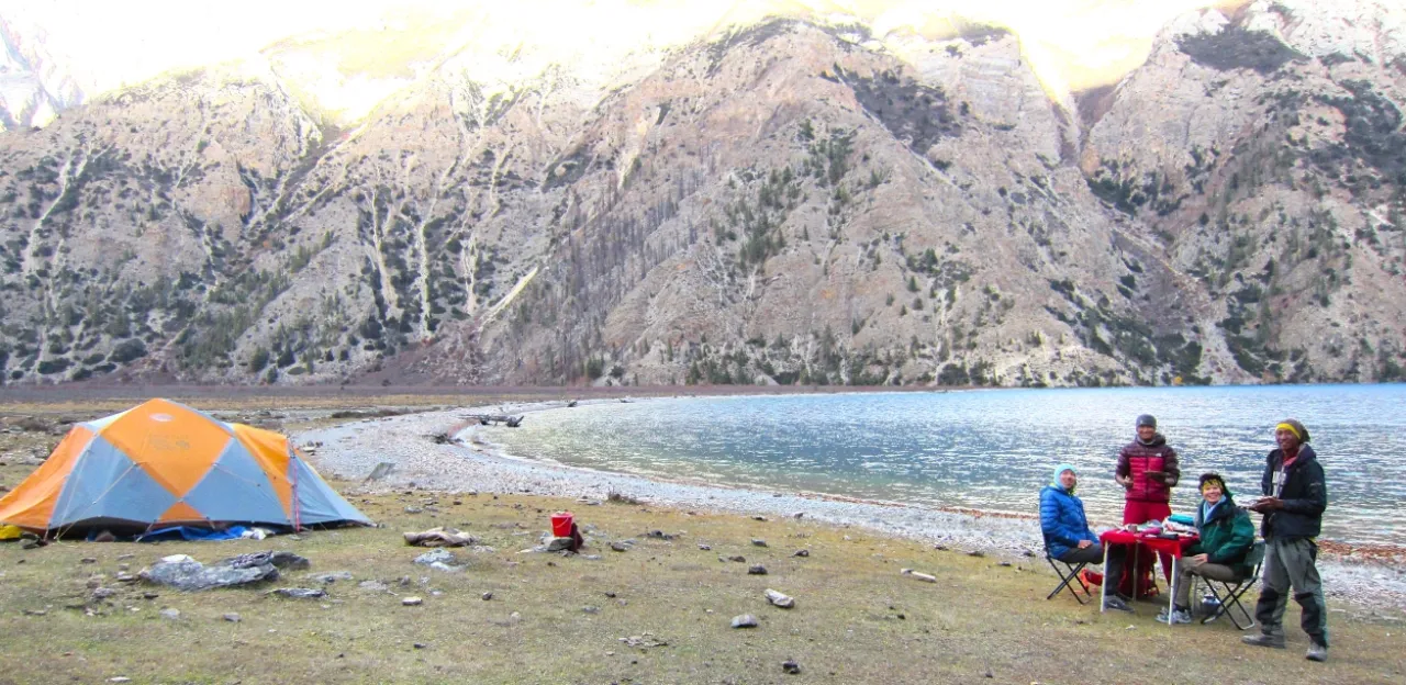
Upper Dolpo Trek
Introduction: Upper Dolpo Trek
The Upper Dolpo Trek is one of Nepal’s most remote and extraordinary trekking adventures. The trek takes you deep into a hidden region where ancient Tibetan culture and untouched landscapes still thrive. Located in the far northwestern corner of Nepal, Dolpo offers a rare opportunity to explore an untouched paradise that remains relatively unexplored by mainstream tourism or development.
This high-altitude trek leads through the dramatic wilderness of Shey Phoksundo National Park. You will be trekking across rugged terrain, deep valleys, and windswept plateaus near the Tibetan border. Along the way, trekkers also encounter traditional villages, centuries-old monasteries, and sacred landmarks such as Shey Phoksundo Lake and Shey Gompa (which hold deep spiritual significance for local communities).
Overview: Upper Dolpo Trek
The Upper Dolpo Trek is a long-duration, high-altitude camping trek in the remote trans-Himalayan region of western Nepal. Known for its isolation but cultural richness, this journey combines challenging mountain terrain with deep cultural immersion. So, the trek can be considered as one of the most unique trekking experiences in Nepal.
Unlike popular trekking routes, Upper Dolpo requires careful planning, special permits, and a fully supported expedition team. The trek typically spans over three weeks, crossing multiple high passes and remote settlements while offering unparalleled access to pristine Himalayan landscapes.
Quick Facts: Upper Dolpo Trek
| Trek Facts | Details |
| Duration | 22-24 Days |
| Maximum Altitude | ~5,380 meters (Kang La Pass) |
| Trek Difficulty | Strenuous / Challenging |
| Accommodation/Trekking Style | Fully supported camping trek |
| Region | Dolpo (Western Nepal) |
| Best Season | May-June & Sep–Nov |
| Permits Required | Restricted Area Permit + National Park Permit |
| Group Type | Private / Small Group |
Upper Dolpo Trek Route Overview
The journey begins with a flight from Kathmandu to Nepalgunj, followed by a dramatic mountain flight to Juphal. From here, the trail quickly leaves behind any signs of modern infrastructure, entering an isolated landscape that defines the Dolpo experience.
The route at a glance:
Kathmandu → Nepalgunj → Juphal (Trek Start) → Dunai → Chhepka → Ringmo → Shey Phoksundo Lake → Shey Gompa → Kang La Pass → Saldang → Dho Tarap → Tarap Valley → Juphal → Nepalgunj → Kathmandu
The Upper Dolpo Trek can be understood in distinct phases, each offering a different landscape, cultural experience, and level of difficulty.
- Phase 1: Entering Dolpo (Juphal → Dunai → Chhepka → Ringmo)
This initial section follows river valleys and forests as you gradually enter the Dolpo region. The trail is relatively moderate, allowing your body to adjust as you pass through small settlements and ascend to Shey Phoksundo Lake. - Phase 2: Sacred & High-Altitude Core (Ringmo → Shey Gompa → Kang La Pass)
This is the spiritual and physical heart of the trek. You explore Shey Gompa and cross high passes like Kang La. Expect thinner air, harsher terrain, and some of the most dramatic scenery of the journey. - Phase 3: Remote Upper Dolpo Plateau (Saldang Region)
After crossing into Upper Dolpo, the landscape opens into a vast, dry plateau with strong Tibetan influence. Villages like Saldang showcase traditional lifestyles and deep cultural isolation. - Phase 4: Descent via Tarap Valley (Dho Tarap → Tarap → Juphal)
The final phase gradually descends through wide valleys and culturally rich villages like Dho Tarap. The terrain becomes greener and more forgiving as you return toward Juphal.
Rather than reaching a destination, this trek is about traversing one of Nepal’s last untouched frontiers, where each section of the trail reveals a new layer of landscape, culture, and isolation.
Trekking Experience in Upper Dolpo
The trekking experience in Upper Dolpo is best described as a true wilderness expedition. It is known to offer a rare combination of physical challenge, isolation, and cultural immersion. This journey is not defined by comfort, but by the depth of experience it delivers.
- Physically demanding terrain
The trek involves long walking days (often 6–8 hours), across rugged and sometimes exposed trails at high altitude. Endurance and prior trekking experience are highly recommended. - Complete immersion in nature
With limited settlements along the route, trekkers spend extended periods surrounded by untouched landscapes, enhancing the sense of remoteness and exploration. - Expedition-style support system
A team of guides, cooks, and porters ensures safety and comfort, managing logistics such as meals, camping setup, and navigation. - Trekkers should also know that due to the lack of teahouses, the trek is entirely camping-based, requiring a support crew and careful logistical planning throughout the journey.
For those prepared for the challenge, this trek offers something increasingly rare in modern travel: a genuine sense of exploration, where the journey feels raw, personal, and deeply rewarding.
Culture of Dolpo: A Living Tibetan Heritage
Upper Dolpo is also a cultural stronghold, preserving traditions that have remained largely unchanged for centuries. Its isolation has allowed a unique Himalayan identity to thrive, deeply rooted in Tibetan heritage.
- Preserved Tibetan traditions
The region’s culture closely mirrors that of Tibet, with traditional architecture, clothing, and daily practices still widely maintained. - Deep-rooted spiritual practices
Both Tibetan Buddhism and the ancient Bon religion are practiced here, influencing every aspect of village life, from seasonal festivals and rituals to daily activities. - Unique social systems and lifestyle
In some areas, practices like polyandry still exist, reflecting adaptations to the harsh environment and limited resources. - Historic trans-Himalayan trade
Dolpo has long been part of ancient trade routes, where locals exchanged salt, wool, and grains with Tibet, a tradition that continues in limited forms to this day.
Shey Gompa & Spiritual Significance
Shey Gompa is one of the most spiritually significant landmarks in Upper Dolpo. Its remote location and historical importance make it a place of both cultural and religious reverence.
Founded in 1220 AD, Shey Gompa has served as a center of religious learning and spiritual practice for centuries. It is situated at the base of Shey Rinpoche (Crystal Mountain), and the monastery is part of a revered pilgrimage circuit.
Pilgrims gather periodically to perform a sacred circumambulation (kora) around the mountain, a practice comparable to rituals at Mount Kailash. Within the monastery, ancient thangkas, statues, and manuscripts are housed, reflecting the region’s profound spiritual heritage.
Hidden Beauty of Upper Dolpo: Nature & Wildlife
The Upper Dolpo Trek passes through Shey Phoksundo National Park. This region is a vast and ecologically significant region that showcases some of the least disturbed landscapes of Nepal.
- The largest national park in Nepal
The park encompasses a diverse range of ecosystems, from dense forests to high-altitude desert terrain, all shaped by extreme climatic conditions. - Iconic Shey Phoksundo Lake
The stunning Shey Phoksundo Lake is renowned for its deep turquoise color and tranquil surroundings, making it one of the visual highlights of the trek. - Rare and elusive wildlife
The region supports species such as the snow leopard and Himalayan blue sheep, reflecting its ecological importance and conservation value. - Rich medicinal plant diversity
Local communities rely on a wide range of herbs and plants for traditional medicine, adding another layer of ecological significance.
Challenges of Upper Dolpo Trek
The Upper Dolpo Trek is as demanding logistically as it is physically. So, it requires careful preparation, flexibility, and a realistic understanding of the conditions.
- Weather-dependent flights to Juphal
Flights are often delayed due to unpredictable mountain weather, which can affect travel plans and require buffer days. - Extreme remoteness and limited facilities
The lack of infrastructure results in limited access to medical care, communication, and basic services throughout much of the trek, with the alternative being helicopter access. - High altitude and acclimatization needs
With elevations exceeding 5,000 meters, altitude sickness is a significant risk, making proper acclimatization essential. - Camping-based trekking conditions
The absence of teahouses requires a fully supported camping setup, with all logistics managed by the trekking team.
While these challenges are considerable, they are also what make the journey so rewarding. For well-prepared trekkers, Upper Dolpo offers a level of authenticity and adventure that few destinations in Nepal can match.
Everest Base Camp Trek Via Gokyo
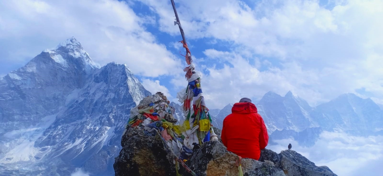
Everest Base Camp Trek via Gokyo Lakes & Cho La Pass
The Everest Base Camp Trek via Gokyo Valley is one of the most breathtaking and adventurous alternatives to the classic EBC trek. It combines the serenity of the Gokyo Valley with the iconic Everest Base Camp, offering trekkers a rare blend of pristine glacial lakes, golden alpine pastures, and towering Himalayan peaks, including Mt. Everest (8,848m), Lhotse, Cho Oyu, and Makalu.
The Gokyo Valley is well-renowned for the Ngozumpa Glacier, the largest glacier in the Himalayas, and its series of emerald lakes born beneath the dramatic Himalayan peaks. Adding to that, Everest Base Camp is the ultimate destination for adventurers. Along the way, trekkers encounter Sherpa villages, ancient monasteries, fluttering prayer flags, and breathtaking panoramic views, offering both adventure and cultural immersion.
Gokyo Lakes & Gokyo Ri
The Gokyo Lakes are among the most stunning glacial lakes in the Himalayas, showing you why this trek is truly unique. Nestled in the high-altitude Gokyo Valley, these lakes offer trekkers a combination of natural beauty, serenity, and cultural significance, forever etched in their minds:
- Six Turquoise Glacial Lakes: The trail passes Gokyo, Thonak, and Ngozumpa Lakes, each shimmering in brilliant shades of turquoise and reflecting the Himalayan towers in the backdrop. These lakes are not only breathtaking but are also considered sacred by local Sherpas and Tibetan Buddhists, with many pilgrims performing rituals during festivals.
- Emerging from the Ngozumpa Glacier: These lakes are fed by the largest glacier in Nepal & the Himalayas, the Ngozumpa Glacier, providing dramatic moraine landscapes and crystal-clear waters. Trekkers walk along glacial moraines and scattered icebergs, offering a sense of thrilling adventure and high-altitude wilderness.
- Unique Ecosystem: The lakes are home to rare Brahminy ducks, Himalayan frogs, and alpine flora, which change with the seasons. In spring, rhododendrons bloom along lower trails, while autumn offers clear skies perfect for photography.
- Photographer’s Paradise: With reflections of Everest, Cho Oyu, Lhotse, and Makalu in the calm waters, the lakes provide one of the most iconic Himalayan photo opportunities, especially during sunrise and sunset.
Gokyo Ri vs Kala Patthar: Which Viewpoint Should You Choose?
Gokyo Ri and Kala Patthar are both breathtaking viewpoints on the Everest Base Camp trek, but each offers a different kind of experience. Choosing between them depends on what you value most: panoramic diversity with opportunities for photography or a close-up view of Everest.
| Feature | Gokyo Ri | Kala Patthar |
| Altitude | 5,360 m | 5,545 m |
| Crowd Levels | Moderate with quieter trails | Higher as it is the Classic EBC route |
| View Scope | 360° panorama of multiple Himalayan peaks | Close-up, dramatic view of the Everest South Face |
| Best Time for Photography | Sunrise with soft lighting, minimal crowds | Sunset with golden-hour highlights on Everest |
| Difficulty of Ascent | Moderate | Moderate to Challenging |
| Unique Appeal | Tranquil and panoramic | Iconic Everest-focused experience |
Ngozumpa Glacier Experience
Walking along the Ngozumpa Glacier is a defining adventure of the Gokyo route:
- Moraine Crossing: Trekkers traverse rocky ridges and moraine fields that extend from the glacier, offering a hands-on experience of glacial terrain rarely seen on standard EBC routes.
- High-Altitude Challenge: The terrain requires steady footing, proper footwear, and careful pacing, giving trekkers a real sense of adventure at extreme elevations.
- Unique Scenic Contrast: The contrast of turquoise lakes against icy moraine and rugged peaks is striking and creates photo opportunities that are unique to this route.
- Photography & Reflection: The glacier offers mirror-like surfaces after snowfall or rain, providing rare reflections of surrounding peaks. Sunrise and sunset light dramatically enhance the icy landscape.
The combination of Gokyo Lakes, Gokyo Ri, and the Ngozumpa Glacier is what makes the Everest Base Camp trek via Gokyo a must-try, exclusive, high-altitude adventure:
- Dual Iconic Viewpoints: More variety than Classic EBC.
- Pristine, Less Crowded Trails: Serenity and photography opportunities.
- Unique Natural Landscapes: Lakes, glaciers, and high passes all in one trek.
Cho La Pass: Difficulty, Terrain & Trekking Insights
The Cho La Pass (5,420 m) is the highest and most challenging point on the EBC via Gokyo trek. It connects the Gokyo Valley with the Khumbu region, offering trekkers an adventurous experience across glaciers, moraines, and high-altitude ridges. Crossing the pass is not only physically demanding but also highly rewarding, with unparalleled Himalayan vistas in all directions.
| Feature | Details |
| Altitude | 5,420 m |
| Difficulty | Moderate to Challenging |
| Terrain | Glacier, moraine, scree, rocky ridges |
| Time Required | 5–7 hours, depending on weather and trekking speed |
| Seasonal Risks | Snow, ice, possible closure in winter/early spring |
| Equipment Needed | Trekking poles, crampons, and layered clothing |
| Acclimatization | Recommended at Gokyo and Tangnag before crossing |
| Physical Requirements | Stamina, balance, and previous trekking experience at high altitudes are recommended |
While challenging, proper preparation, acclimatization, and professional guidance make it achievable for experienced trekkers. Crossing this pass is one of the defining experiences that sets the EBC via Gokyo trek apart from the classic route.
Route Overview: 16-Day Circular Trek from Lukla
Our carefully designed 16-day itinerary balances ample time for both adventure and acclimatization, ensuring trekkers fully experience the region’s scenic and cultural richness.
- Day 1–3: Lukla → Phakding → Namche Bazaar (acclimatization)
- Day 4–6: Namche Bazaar → Gokyo Valley → Gokyo Ri ascent
- Day 7–8: Gokyo → Cho La Pass → Dzongla (glacier crossing)
- Day 9–11: Gorak Shep → Kala Patthar → Everest Base Camp
- Day 12–16: Return via Tengboche Monastery → Lukla → Ramechhap → Kathmandu
Altitude & Trekking Hours Table:
| Segment | Altitude Gain | Trekking Hours | Notes |
| Lukla → Namche | 3,440 m | 5–6 | Steep ascent, suspension bridges |
| Namche → Gokyo | 4,790 m | 6–7 | Gradual acclimatization, lake views |
| Gokyo Ri → Cho La Pass | 5,420 m | 7–8 | Glacier crossing, high pass challenge |
| Gorak Shep → Kala Patthar | 5,545 m | 3–4 | Sunset views over Everest |
| Kala Patthar → EBC | 5,340 m | 2 | Base camp experience |
Challenges of the Everest Base Camp Trek via Gokyo Valley
- High Altitude Demands: The trek reaches 5,545m (Kala Patthar), 5,420m (Cho La Pass), and 5,340m (EBC). At these elevations, altitude sickness symptoms like headaches, nausea, and fatigue are common, making acclimatization critical.
- Cho La Pass Crossing: Cho La Pass (5,420m) involves steep, rocky, and often icy terrain. Snow can increase difficulty, requiring good fitness and trekking experience.
- Glacial Terrain: The route crosses the Ngozumpa Glacier, with uneven moraines, slippery ice, and occasional crevasses. Careful footing is essential.
- Remote Sections: Gokyo Valley and Cho La are quieter and more isolated than the classic EBC route. Facilities are basic, and medical access is limited.
- Unpredictable Weather: The weather can change quickly with snow, wind, and temperature drops. Lukla/Ramechhap flights are also prone to delays.
- Physical Endurance: Expect 5–8 hours of daily trekking with steep ascents. The longer route adds cumulative fatigue.
- Cold Exposure: Nights in Gokyo, Dzongla, and Gorak Shep are freezing, requiring proper gear and preparation.
Everest Base Camp Trek
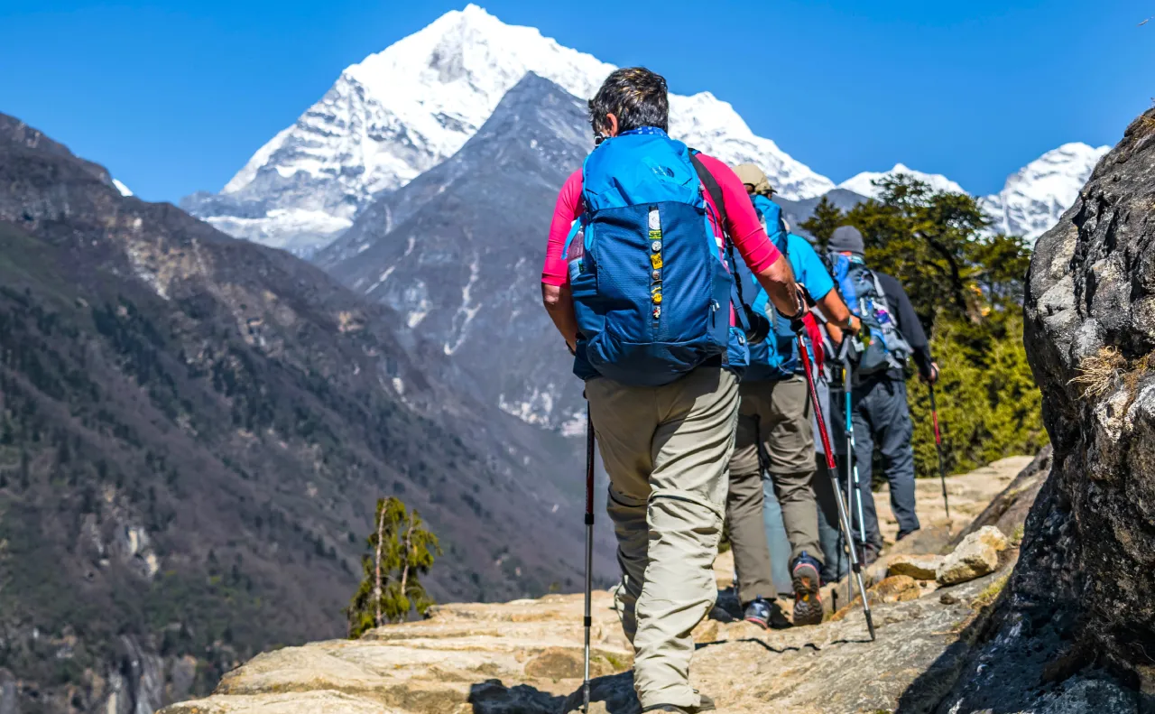
The Everest Base Camp Trek is considered one of the most iconic high-altitude adventures in the world. Since the 1920s, trekkers and thrill-seekers from across the globe have dreamed of standing at the foot of Mt. Everest (8,849 m), the highest peak on Earth, while being surrounded by the awe-inspiring giants of the Himalayan Range.
This journey is more than a trek; it is a profound encounter with nature, culture, and personal endurance.
Traversing the Khumbu region, you will experience a tapestry of breathtaking landscapes and rich cultural heritage: vibrant Sherpa villages, intricately carved mani walls, ancient chortens, colourful prayer flags, and centuries-old Buddhist monasteries.
Swaying suspension bridges cross the glacial rivers that test your courage, while panoramic views of the snow-clad peaks create monumental moments that are forever etched in your mind and spirit.
Our 17-day classic Everest Base Camp Trek itinerary flies you in and out of Lukla, with carefully planned acclimatisation stops, ensuring safety and comfort while you explore these high altitudes.
Highlighting the EBC Trek: Duration, Distance & Maximum Altitude
- Duration: 17 Days (13 days trekking + Kathmandu & Ramechhap)
- Distance: Approximately 130–140 km round trip for the classic route
- Highest Altitude covered: 5,545 m/18,192 ft at Kala Pathar, with Everest Base Camp at 5,340 m/17,500 ft
- Difficulty: Very demanding / High-altitude trek requiring good fitness and preparation
This trek involves 5–7 hours of walking per day across steep trails, high ridges, and rugged terrain, making proper preparation and acclimatisation essential.
Where is Everest Base Camp Located?
Everest Base Camp is located in Nepal’s Khumbu region, within the boundaries of Sagarmatha National Park. Nestled at the foot of the Khumbu Icefall, it serves as the launching point for climbers attempting to summit the world’s highest point.
Trekkers typically begin their journey with a scenic flight from Ramechhap to Lukla (2,860 m), followed by trekking through the picturesque Sherpa villages, suspension bridges, and high Himalayan landscapes until reaching the base of the world’s tallest mountain.
Classic Everest Base Camp Trek Itinerary
Our 17-day Everest Base Camp Trek itinerary takes you through some of the most iconic landscapes of the Khumbu region:
- Flight to Lukla (2,860 m): Begin with an early morning flight from Ramechhap to Lukla (2,860m), the gateway to the trek. Marvel at the views of Kusum Kanguru Peak (6,367m) as you start your trek.
- Namche Bazaar (3,450 m): Cross the Dudh Koshi River via suspension bridges and ascend to this vibrant Sherpa town, which is a key acclimatisation stop.
- Dingboche (4,360 m): Trek through Phortse village (3,800 m), enjoy sweeping views of Ama Dablam, while spending two nights acclimatising here.
- Kala Patthar (5,545 m): Witness an unforgettable sunset over Mt. Everest, perfect for photography and reflection.
- Everest Base Camp (5,340 m): Arrive at the Khumbu Icefall, the bustling hub for mountaineers during the climbing season.
Our itinerary, while following the classic Everest Base Camp route, thoughtfully incorporates selected alternative sections that offer fewer crowds, better acclimatisation, and deeper cultural immersion.
Challenges of the Everest Base Camp Trek
While this trek is immensely rewarding, it requires careful planning and awareness of potential challenges:
- High-Altitude Risks: Trekking above 5,500 m poses the potent risk of altitude sickness. Severe cases may require emergency evacuation.
- Unpredictable Flights: Flights to and from Lukla are heavily weather-dependent, with delays and cancellations for several days being quite common.
- Access to Lukla: Although we try our best to get direct flights to Lukla from Kathmandu (the best option), due to flight congestion in Kathmandu airport, the flights to Lukla nowadays mostly operate from Ramechhap (Manthali Airport).
- Road to Ramechhap: A 6-hour drive, with alternating good and bad road stretches along the route.
- Accommodation Limitations: Lodges in Ramechhap are basic and limited. Weather-related flight delays (sometimes stretching up to two days) can impact the availability of accommodation.
- Trail Retracing: The standard trekking route requires retracing your steps back along the same path, which some trekkers may find repetitive.
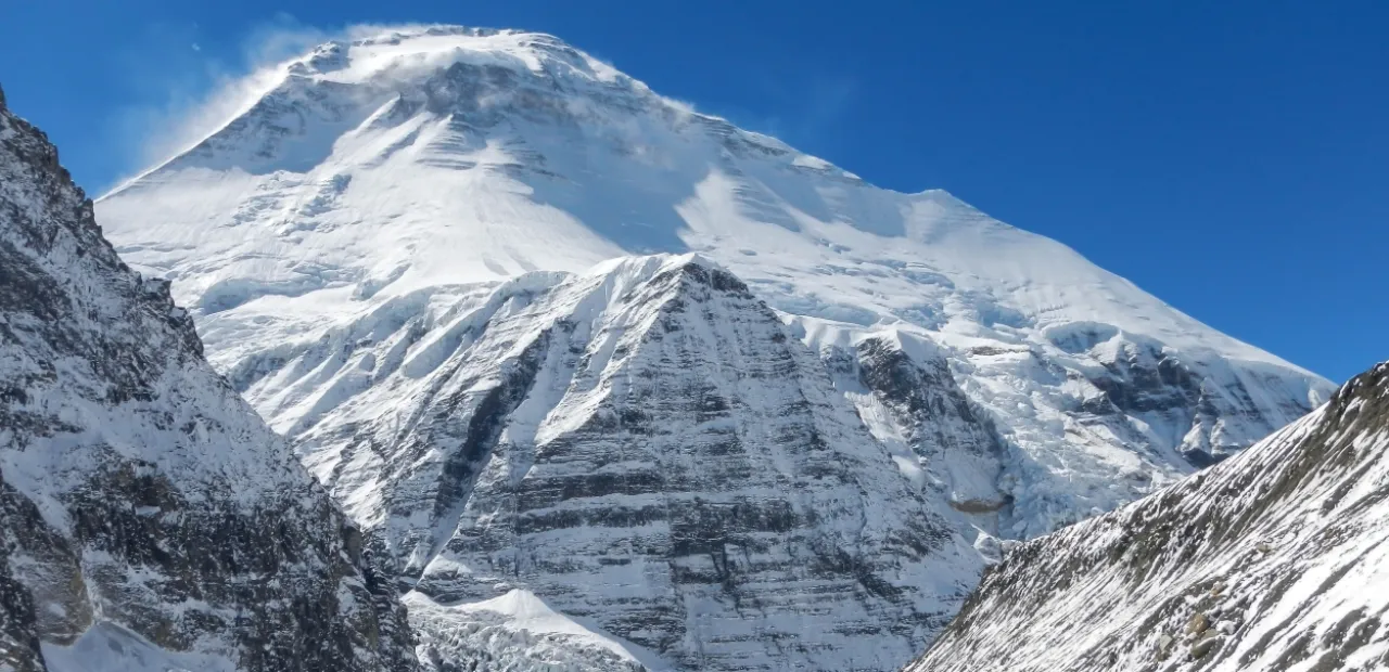
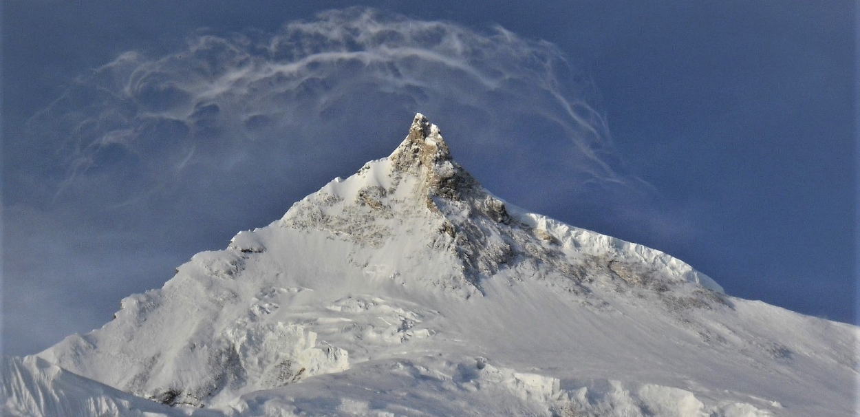
Dhaulagiri Trek
Overview: Dhaulagiri Trek
The Dhaulagiri Trek is one of Nepal’s most remote and demanding trekking adventures, located in the northwest of Pokhara. This epic journey takes trekkers around the majestic Dhaulagiri massif, offering a once-in-a-lifetime experience through rugged terrains, isolated valleys, high mountain passes, and pristine alpine landscapes.
Towering at 8,167 meters, Mount Dhaulagiri I was once believed to be the highest mountain in the world. Today, it proudly holds the title of the seventh highest peak on the planet. The massif comprises 15 peaks above 7,000 meters, making this trek a paradise for mountaineers and adventure lovers.
What Makes the Dhaulagiri Trek Unique?
Dhaulagiri trek is an off-the-beaten-path trek which offers a spectacular mix of natural beauty and cultural richness. Starting from the fertile lowlands and traditional villages inhabited by Magar and Gurung communities, the trail climbs through dense forests, wild rivers, glaciers, and dramatic high passes.
During Dhaulagiri 17 days trek one will witness a transition from terraced farmland to stark, icy wilderness as they ascend. The journey is physically and mentally demanding, often requiring the use of crampons, ice axes, helmets, and ropes. Prior experience with high-altitude trekking and glacier walking is essential for safety.
Highlights: Dhaulagiri Trek:
- Explore a remote region of central Nepal with less trekkers on the trail
- Cross two major high passes: French Pass (5,360m) and Dhampus Pass (5,240m)
- Camp under the stars at 5,200m in the Hidden Valley
- Spectacular views of Dhaulagiri (8,167m), Annapurna (8,091m), and several lesser-known peaks
- Encounter a rich variety of flora and fauna, including endangered Himalayan species
- Experience both camping and lodge accommodation
- Immerse in local culture through interaction with Gurung and Magar communities
- Optional side trip to Dhampus Peak (6,060m) — a non-technical trekking peak
Trek Challenges and Considerations: Dhaulagiri Trek
- High altitude risk: Possibility of altitude sickness despite acclimatization days
- Rough and remote terrain: Expect steep ascents/descents, glaciers, and rocky trails
- Unpredictable weather, especially in high passes
- No access to medical facilities or modern amenities for days
- Trekking route may close during heavy snowfall, particularly at the passes
Route: Dhaulagiri Trek
The Dhaulagiri Days trek begins from Sibang village, reached by a short flight from Kathmandu to Pokhara followed by an 8-hour drive. The early days follow the beautiful Myagdi Khola river, weaving through terraced fields and lowland forests.
As elevation increases, the trail leads to Italian Base Camp and then Dhaulagiri Base Camp, surrounded by towering peaks. The real challenge begins as trekkers cross the French Pass (5,360m) into the Hidden Valley, a high-altitude plateau rich in biodiversity.
After resting in the valley, trekkers tackle the Dhampus Pass (5,240m) before descending to Marpha village, a picturesque Thakali settlement on the Kali Gandaki River. From here, a local jeep takes you to Beni, and the journey ends back in Pokhara.
Final Thoughts: Dhaulagiri Days Trek
The Dhaulagiri Days Trek is not for beginners — it’s for seasoned adventurers seeking an unfiltered Himalayan experience. The combination of extreme altitude, remote trails, and surreal beauty makes this one of Nepal’s most rewarding treks.
Are you ready to challenge yourself and walk along one of the most dramatic and challenging trekking routes on Earth? The Dhaulagiri 17 Days trek awaits.
Upper Mustang Trek
Overview: Upper Mustang via Nar Valley – A Hidden Gem in the Annapurna Region
The Upper Mustang trek via the Nar Valley in central Nepal is an ideal trek trip for approaching the walled city of Lo Manthang via a remote alternate trek trail escaping the previously well-traveled route, which has been somewhat disrupted by the road.
This trail is an ancient salt trade route connecting the two great mystical places Nar and Upper Mustang in a weeklong traverse through wild, uninhabited areas with crossing of the high Teri La Pass (5,560m)
The gorgeous valley with fortified Tibetan Villages of Nar to an arid and dry Upper Mustang enriches the experience of travelers with an ancient Tibetan cultures and Buddhist traditions. Upper Mustang trek via Nar valley allows you to have the experience of the off beaten trails, challenges of crossing of high pass, encountering remote villages with ancient Tibetan features which is well preserved till date, the age-old monasteries, exploration of 3 to 4 century ancient caves, amazing landscapes, rock formations and without missing the superb views of the Himalayas.
Nar Village: Nar at 4,110 m is a treasure trove of ancient Buddhist houses, monasteries some dating back over thousand years. Here one can witness the ancient settlement and experience the rich Tibetan culture in an undisturbed form. You can see the locals with traditional dress showcasing their distinct cultural identity. The dramatic mountain views and great alpine scenery surround the village. Mountains like Annapurna II, Gangapurna and Tilicho Peak can be seen during good weather days.
Teri La Pass (5,560m): Teri La (pass) at 5,560 m north of Upper Mustang and close to Damodar Mountain is a remote, adventurous serene high-walking crossing. Although categorized as an easy one but due to remoteness and altitude the crossing can be challenging one. But the challenges are rewarded with a breathtaking 360° Himalayan vista from the summit.
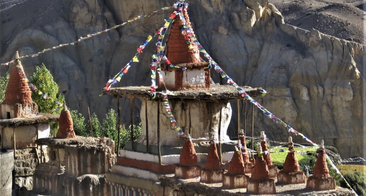
Lo Manthang: Lo Manthang in Upper Mustang is the ancient capital city of Upper Mustang with strong ancient Buddhist cultures, thousand years old monasteries, mysterious cave and amazing landscapes. Founded in 1380, it is also called the Walled City of Upper Mustang. Most of the local houses are built out of mud brick.
Once upon a time, the district of Mustang was a part of the Tibetan empire. Sheltered from hyper-commercialized forms of tourism, it is known as the last bastion of authentic Tibetan culture. The trek through this region therefore involves uncovering the hidden mysteries of this ancient world.
Highlights: Upper Mustang Trek via Nar Valley
- Visit Nar Village (4,110m) – a hidden Tibetan village with authentic Buddhist architecture, traditional lifestyles, and dramatic mountain backdrops.
- Cross the wild and remote Teri La Pass (5,560m) – a challenging yet rewarding high-altitude crossing with breathtaking views.
- Explore the mysterious caves and monasteries of Upper Mustang, some dating back to the 14th century.
- Discover Lo Manthang – the ancient capital of Mustang with its royal palace, monastic complexes, and rich Tibetan heritage.
- Traverse exotic landscapes filled with deep canyons, red rock cliffs, eroded formations, and colorful desert-like scenery.
- Trek through a part of the ancient salt trade route that once connected Tibet with Nepal.
Trek Route: Upper Mustang Trek via Nar Valley
Your adventure begins with a scenic drive from Kathmandu to Besisahar, followed by an off-road journey to Dharapani, the starting point of the trek. The trail ascends through Nar Valley, where you acclimatize and explore the village before heading toward the high, remote Teri La Pass. After crossing the pass, the trail descends into the magical terrain of Upper Mustang, culminating in Lo Manthang.
From Lo Manthang, you’ll return via Jomsom, visiting ancient cave systems and heritage sites along the way, before flying back to Kathmandu
Is This Trek for You?
If you’re seeking something beyond the typical Everest or Annapurna Circuit, and you’re ready to take on a remote, physically demanding trek through spiritual landscapes and untouched cultures, then Upper Mustang Trek via Nar Valley is the perfect journey.
Kanchenjunga Trek

Overview of the Kanchenjunga Trek
Explore the Remote Base Camps of the World’s Third-Highest Mountain
The Kanchenjunga Trek is a remote and adventurous Himalayan journey that takes you to both the North and South Base Camps of Mount Kanchenjunga (8,586 m). It can be done as a full circuit or shorter base camp variations, offering a challenging yet less crowded alternative to Everest and Annapurna treks.
Located in the far eastern region of Nepal near the Indian border, this trek is perfect for those seeking raw wilderness, fewer crowds, and a truly off-the-beaten-path experience.
This circular trekking route passes through the traditional homelands of the Rai, Limbu, and Sherpa communities, offering a rare blend of cultural depth and natural beauty. Along the way, you’ll encounter everything from lush subtropical forests and terraced hills to alpine meadows, glaciers, and high mountain passes.
The region lies within the pristine Kanchenjunga Conservation Area, a rich biodiversity hotspot home to rare wildlife such as the red panda, snow leopard, Himalayan black bear, clouded leopard, and Assamese macaque.
Despite its physical demands and remoteness, the Kanchenjunga Trek rewards you with unmatched solitude, dramatic landscapes, and one of the most authentic trekking experiences in Nepal.
Kanchenjunga Trek: Quick Details
- Location: Eastern Nepal, in the remote Kanchenjunga region near the Sikkim border(India)
- Duration: 18–26 days (depending on route and acclimatization days)
- Max Altitude: 5,143 m (North Base Camp – Pang Pema)
- Difficulty: Strenuous. Best suited for experienced trekkers with strong fitness and prior high-altitude exposure
- Cost: $1,800–$3,500 (varies by itinerary, group size, and service level)
- Best Time to Trek: Spring (March to May) and Autumn (Mid-October to November) for stable weather and clear mountain views
- Trail Type: Remote wilderness trek with long walking days, rugged terrain, river crossings, alpine landscapes, and glacier viewpoints
- Permits Required: Restricted Area Permit (RAP) and Kanchenjunga Conservation Area Permit (KCAP)
- Guide Requirement: Mandatory. Solo trekking is not allowed in the restricted Kanchenjunga region.
- Group Join Available: Yes, with fixed departures and shared cost options
Plan your Kanchenjunga Trek with local experts or join a group departure for a safer, more cost-effective adventure.
Kanchenjunga Trek Route Overview (18–26 Days)
The Kanchenjunga Trek follows a remote circular route in eastern Nepal, starting with a flight to Bhadrapur and a long drive to Taplejung. The trail gradually ascends through traditional villages, dense forests, and alpine landscapes before reaching both the North and South Base Camps of Mount Kanchenjunga, then looping back through the southern valleys.
Day 1–2: Arrival in Kathmandu → flight to Bhadrapur → drive to Taplejung (trek preparation and permits)
Day 3: Jeep drive to trek starting point → begin trek through lower hill villages.
Day 4–8: Trek through Sekathum, Amjilosa, and Gyabla → enter remote valleys and forests.
Day 9–11: Trek via Ghunsa → acclimatization and gradual altitude gain
Day 12–14: Trek to Pangpema (5,143 m) → North Base Camp with views of glaciers and peaks like Kumbhakarna
Day 15–17: Return to Ghunsa → transition toward southern route via high mountain passes
Day 18–20: Trek to Ramche and Oktang → South Base Camp with views of the Yalung Glacier and Kanchenjunga’s south face
Day 21–23: Descend through villages like Khebang → forests, terraced fields, and cultural settlements
Day 24–26: Drive back to Bhadrapur → flight to Kathmandu
This route offers a complete Himalayan experience, combining remote wilderness, cultural villages, and both base camps in one epic journey.
Challenges and Considerations: Kanchenjunga Trek
The Kanchenjunga Trek is an isolated wonderland, but it demands preparation and awareness. Trekkers should understand the key challenges to stay safe and enjoy the journey.
- High Altitude Risks (5,143 m+): The trek reaches extreme elevations at North Base Camp, increasing the risk of altitude sickness. Proper acclimatization, hydration, and pacing are essential for safety.
- Long & Physically Demanding Route: This is a strenuous 18 to 26-day circuit with long walking hours, steep ascents, and remote terrain. The trek is best suited for trekkers with strong fitness and prior high-altitude experience.
- Basic Accommodation & Limited Facilities: Expect simple teahouses with basic and minimal amenities. The remoteness of the region means comfort takes a backseat to authenticity.
- Challenging Access & Travel Logistics: Direct flights to Suketar (Taplejung) are unreliable, so most itineraries involve flying to Bhadrapur followed by a long, bumpy 7–9 hours drive to reach the trailhead.
- Unpredictable Mountain Weather: Conditions can change rapidly, especially at higher altitudes and near passes, requiring flexibility in itinerary and proper gear preparation.
Manaslu With Annapurna Trek
Manaslu With Annapurna Trek: Overview
Manaslu with Annapurna trek is a 23-day adventure in the central part of Nepal. This central region of Nepal is dominated by giant lofty Himalayas like Manaslu (8,163 m), Annapurna Ranges (8,091 m), and many other Himalayan Peaks. Basically, the program is traversing through the foothills of Mt. Manaslu (8,163 m) and Mt. Annapurna range (8,091m), eight and the ten highest peaks in the world. This part of the region has some of the best diverse features of central Nepal. The terrain, landscapes, people, cultures and lofty Himalayas are just amazing. Crossing three high passes above 5,000 m provides you with challenge and rewards you with spectacular views of the high Himalayas. Also, there will be an opportunity to explore the Phu & Nar Valley which was opened to tourism only from 2002. The valley with strong Tibetan culture has medieval stone walled Tibetan villages, impressive Chortens, Monasteries, colorful prayer stones and encountering blue sheep on the trail.
Manaslu With Annapurna Trek: Highlights
- Manaslu Circuit: This segment leads trekkers around Mount Manaslu (8,163 meters), the world’s eighth-highest peak. The trail passes through the Manaslu Conservation Area, offering views of snow-capped mountains, lush forests, and traditional villages. A significant challenge and highlight of this circuit are the crossing of the Larkya La Pass at 5,235 meters, which provides panoramic vistas of the surrounding peaks.l
- Phu and Nar Valleys: Diverging from the main trail, trekkers venture into the remote Phu and Nar Valleys, home to ancient Tibetan-influenced settlements. These villages have preserved their traditional culture, lifestyle, and religious practices. Visiting local monasteries and witnessing daily rituals offers insight into a way of life that has remained unchanged for centuries.
- Annapurna Circuit Integration: After exploring the secluded valleys, the trek converges with the Annapurna Circuit, one of Nepal’s most celebrated trekking routes. This section includes the ascent to the Thorong La Pass at 5,416 meters, presenting trekkers with breathtaking landscapes ranging from arid highlands to verdant subtropical forests.
Manaslu With Annapurna Trek: Challenges
- Manaslu with Annapurna trek is on a high-altitude trail reaching up to 5,416 m which susceptible to altitude problem. This is a real challenge as it can affect anyone depending on an individual from an elevation of 2,500m.
- Altitude effect can be in a different form depending on the individual. In case of severity, one needs to be helicoptered out for immediate medical attention otherwise it can be fatal.
- No proper medical clinic on the trail
- Drive from Kathmandu can be delayed due to ongoing road repairing projects, sometimes you may have traffic jam, and some parts of the drive will be on the unpaved rocky mountain road trail.
- In case of heavy snowfall and if the pass is closed the return trip will follow the same trail back where it started as it does not have an alternate route.
- Weather plays a crucial role for having the successful and enjoyable trek in the Himalayas, so it is necessary to choose the right season for the trek.
- Since Jomsom airstrip is in the mountainous terrain so weather plays a crucial role for the operation of flight. In case of cancellation of flight, the option is driving back to Pokhara through mountainous terrain road which takes around 7 hours. Flight Pokhara Kathmandu is much more reliable so after reaching Pokhara we can take the flight back to Kathmandu. (subject to weather conditions)
Manaslu With Annapurna Trek: Trekking Route
1. Manaslu Circuit
- Starts at Maccha Khola near Arughat and follows the ancient salt-trading route along the Budhi Gandaki River.
- Pass through Gurung communities and Nupri Valley, inhabited by Tibetan-influenced locals.
- Cross Larkya La Pass (5,235m) with breathtaking glacier views.
- Nar Phu Valley
- Diverges from the main Annapurna trail at Koto, leading to the remote and tranquil Nar and Phu villages.
- Explore Tibetan culture, abandoned Khampa settlements, and see herds of blue sheep.
- Cross Kang La Pass (5,320m) and rejoin the Annapurna Circuit.
- Annapurna Circuit
- Continue along the popular Annapurna Circuit, crossing the Thorong La Pass (5,416m) to Jomsom.
- Witness a blend of cultural and natural beauty with more trekkers sharing the trail.
- Conclusion
- Fly from Jomsom to Kathmandu via Pokhara
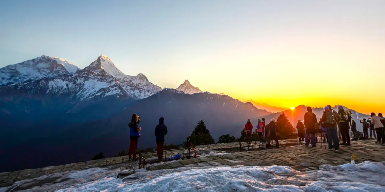
Poon Hill Trek
Overview : POON HILL TREK
Poon Hill trek is one of the most well-liked short treks in Nepal. This trek may be approached from several directions and completed in different time frames by incorporating other beautiful trails. Poon Hill trek route lies north of Pokhara Valley just below the Annapurna Mountain (8,091 m) the 10th highest peak of the world.
Considered a simple hike in Nepal, it provides a relatively low-altitude, breathtaking perspective of the Central Himalayas. From Dhaulagiri (8,167m) and Tukuche (6920m) to Nilgiri (66,940m), Annapurna South, Annapurna I (8,091m), Hiunchuli (6,441m), and Tarke Kang (7,193m), Poon Hill (3,200m) provides the most amazing sunrise view over the Himalayas.
Dotted along the trail are beautiful local villages which provide the insights of the local people. You will also have the chance to tour the Gurung tribe’s museum and old village well preserved. Spring times are even more beautiful as the trails are covered with a vibrant rhododendron forest with breathtaking vistas of Annapurna and Dhaulagiri.
In six days, our Poon Hill trek program combines two well-known mountain viewing locations. Starting at the well-known Poon Hill viewpoint, which is 3,200 meters high, and continuing east past the village of Landruk, which is home to terraced rice fields, a rhododendron forest, and local farming, until arriving at Australian Camp. This is another great spot from where you will enjoy the breath-taking sweeping views of the Annapurna and Dhaulagiri Mountain ranges.
Poon Hill Trek: Highlights
- Striking views of the Central Himalayas Annapurna and Dhaulagiri Mountain ranges
- Mesmerizing views of the sunrise over the Himalayas from the Summit of Poon Hill (3,210m)
- Amazing Sunset views from Australian Camp (2,060m)
- Walk through nature beautiful rhododendron forest, bamboo groves, terraced rice fields, small streams and different species of birds
- Experience the peaceful, serene villages and the insights of locals
- Visit the Gurung Museum and old Gurung village well preserved.
POON HILL: Trek Routes
The trek route to Poon Hill with Australian Camp can be done from different directions. Ours is a usual route which starts from Hille village which is a drive of around 2 hrs from Pokhara. From there we walk to village of Tirkhedunga in an ascending order for lunch. Then we tackle toughest part by climbing the steep stone staircase believed to be around 3300 steps to a Magar village of Ulleri for an overnight stay. This section is the most challenging part in the entire trek route. After spending the night in Ulleri next day our destination is Ghorepani which is a gradual ascend order passing through local villages, rhododendron forest. Morning hike up to Poon Hill (3,200m) to get a mesmerizing view of the sunrise over the sunrise. This is around 01 hour hike up early morning for viewing sunrise with the snowy peaks turning into golden color. Then continue eastward towards Tadapani with some gentle up then descending gradually to Tadapani for an overnight stay. Morning view from can also be magnificent. From here we continue our trek on an easy trail to second largest Gurung Village of Ghandruk which provides excellent view of Annapurna South. Here you can also explore old village and museum of the Gurung tribe. Have lunch then descend down steeply in a stone staircase then a little bit of climb to Landruk for overnight stay. From Landruk our trek goes to Australian Camp through mix trail some part in a jeep trail where there is not much of traffic and other part in a proper trek trail. Australian Camp is another great viewpoint for the mountains – next morning we hope to get some fantastic panoramic of the Himalayas (Weather permitting). After walk to Kande and then drive to Pokhara.
POON HILL: Challenge to Consider
- Since whole of Annapurna region is on a road construction project so some section of the trek will be on the Jeep trail with not much traffic.
- During season time i.e. April you will encounter quite a lot of crowds on the trail
- Because of the busy season getting accommodation can be a problem so early booking is recommended.
- Weather can play foul as trekking in the Himalayas is mostly to see those gigantic snowy peaks. Even during the recommended season, the weather sometimes can go wrong making the trip without the view of the Himalayas.
Langtang Ganja La Trek
Overview: Langtang Ganja La Trek
The Langtang Ganja La Trek offers an incredible blend of natural beauty, cultural immersion, and adventure. Situated approximately 80 kilometers north of Kathmandu, this trail begins in the Langtang Valley, a stunning region renowned for its biodiversity and cultural richness. The trek takes you through subtropical forests, cascading waterfalls, charming Tamang villages, and serene Buddhist stupas adorned with prayer flags.
The journey culminates in the challenging Ganja La Pass at 5,106 meters, where trekkers are rewarded with breathtaking views of the Langtang Range, Ganesh Himal, and, on clear days, even the Annapurna peaks. Acclimatization hikes, including a trek up Tserko Ri (5,000 m), not only prepare you for the high altitude but also provide panoramic vistas of the surrounding peaks.
During spring, the trail comes alive with vibrant rhododendron blossoms, adding a splash of color to the already picturesque landscape. The trek concludes in the Helambu region, known for its Buddhist monasteries and the warm hospitality of the Hyolmo people, offering a perfect ending to this memorable journey.
Highlights: Langtang Ganja La Trek
- Langtang Valley is a relatively short and accessible trekking destination with a fantastic Himalayan experience.
- Relish the beautiful spectacles of Langtang Lirung, Ganesh Himal, Manaslu, and Jugal Himal.
- Breathtaking climb to the vantage point of Tserko Ri at the elevation of 5033m.
- Explore the beautiful Tamang villages and get a more in-depth insight into their cultures and heritages.
- Opportunity to witness rare animals like the red panda, snow leopard, langur, and musk deer.
- Explore the ancient monastery of Kyanjin Gompa.
- Cross Ganja La Pass 5,106 m
Trek Routes: Langtang Ganja La Trek
This Langtang Ganja La trek roughly takes about ten days. Trip starts with a drive of around 6 to 7 hours from Kathmandu on a private four-wheel Jeep to the starting point of the trek. The drive is mostly on a paved mountain road with some stretch on a bad bumpy one.
The actual trek starts from Syabrubensi on an up and down trail with beautiful forest, huge boulders, waterfalls, villages to Lama hotel. Then it is on a single trail along the river, forest, steep ascent with view of the snowy peaks for an overnight stay at Langtang village. Followed by a cultural exploration in the Langtang village, the trek moves to a further higher elevation on a couple of steep and short ascents with beautiful scenery ending at ancient monastery of Kyanjin Gompa. This is the most sacred monastery for the Tamangs in the Langtang region. Here we will spend a couple of nights exploring the place and doing a side trips for acclimatization before crossing the Ganja La Pass (5,130m). Long hike to Tserko Ri (4,984m) for superb views of the mountains as well as for acclimatization. Next part of the trail goes through remote and challenging trail, crosses the Ganja-La Pass (5130m) with view of Mt. Langtang Lirung, Mt. Shishapangma and other Tibetian Peaks to the Hyolmo villages of Helambu. During crossing of the pass couple of nights will be spent on a tented camp. Our trek completes at Tarke Gyang in the Helambu region then next day 06 hours’ drive back to Kathmandu