Tag: highaltitudetrek
So, Which Nepal Treks Are Actually Less Crowded in 2026?
Introduction
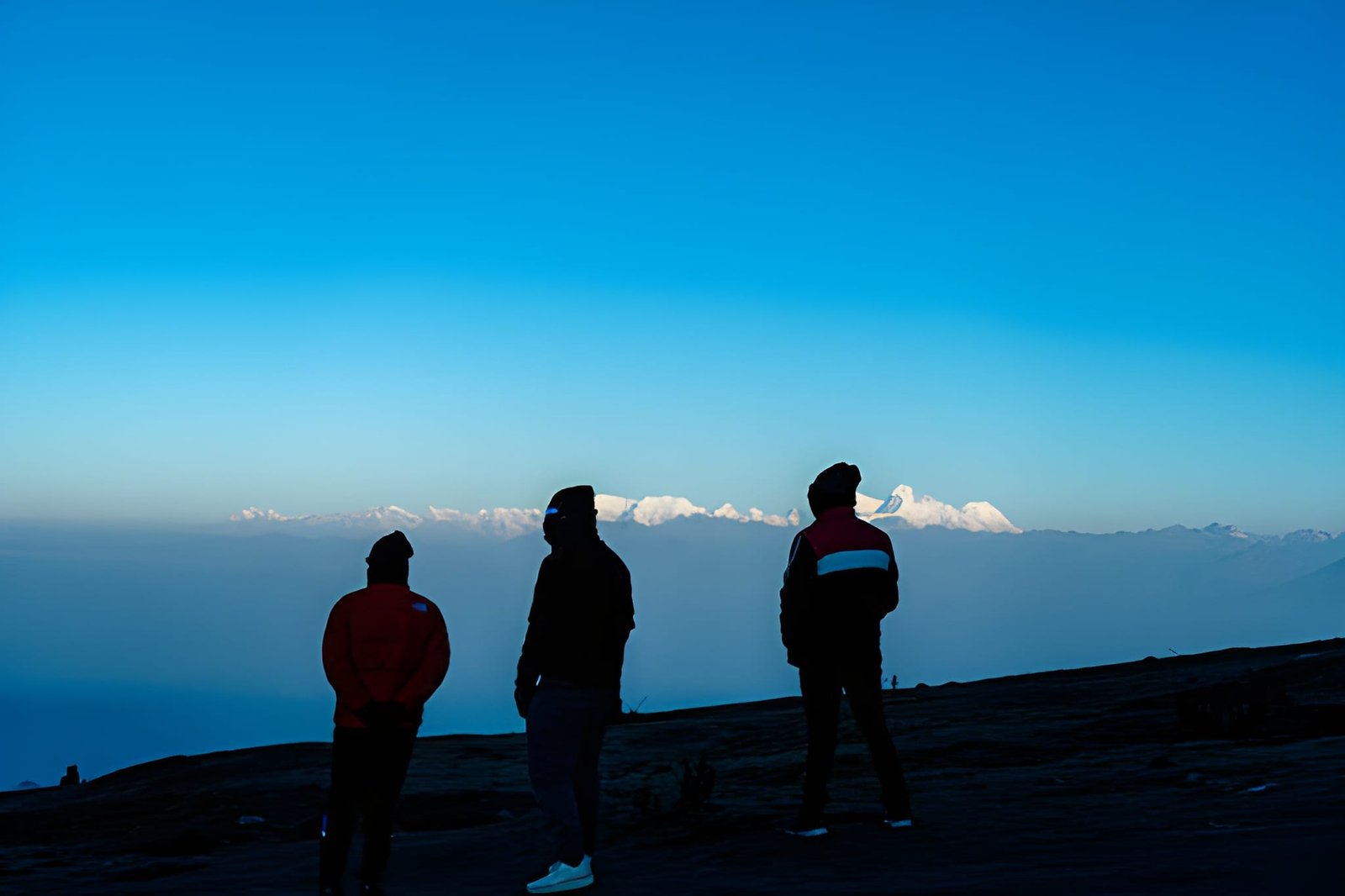
It’s October, and you’ve come to trek EBC, stopping at Namche Bazaar. Every teahouse is full by 2 pm. You can see trekkers queueing for the same viewpoint for a photograph. A guide from another company tells his group this is “the quiet season.”
We’ve been watching this happen for 25 years: this slow conversion of once-genuine routes into managed experiences. It’s nobody’s fault, though. Good trails get discovered. Discovered trails get developed. Developed trails get crowded.
However, Nepal is vast, and the permit system creates genuine barriers, so not every trail ends up as a “hidden gem.” Some routes stay quiet because they ask more of you. This is a guide to those less crowded trek routes, being honest about what’s changed, specific about what hasn’t.
Before the List: What “Less Crowded” Actually Means for Routes in Nepal
Most lists treat “remote” and “less crowded” as interchangeable terms. They’re not.
A trail can be geographically remote and still funnel every trekker through the same two teahouses. A restricted area can still see seasonal surges that make it feel anything but quiet. Understanding the difference is what separates a genuinely peaceful trek from a disappointing one.
Three things actually determine crowd experience on a Nepal trail:
Trail density: How many trekkers share the same path on any given day? Some routes have natural bottlenecks (river crossings, single-file passes) where even 20 people feel like a crowd.
Teahouse availability: Can you get a room without booking months ahead? In peak season on popular routes, teahouses are fully reserved by 2 pm. That changes the entire character of a trek.
Permit volume: Certain areas require restricted area permits that cap annual visitor numbers. This is the most reliable crowd-control mechanism in Nepal trekking, and it’s the reason some routes have stayed genuinely quiet for decades.
One more thing most lists ignore: seasonality distortion. A trek labeled “quiet” is often only quiet in the off-season. Visit that same trail in October or April, and you may find yourself in a convoy. Where we mention seasonality below, take it seriously, as it changes everything.
These Were Considered “Hidden Gems,” But They’re Not Hidden Anymore
Before the ranked list, an honest disclaimer about three treks you’ll still find on most “less crowded” articles.
Mardi Himal: Still a beautiful trek worth doing. But quiet? Not in spring. It’s now a popular short-duration alternative to ABC. The teahouses above Forest Camp also fill fast in March and April. If you do it, go in November or early December.
Langtang Valley: The post-2015 earthquake rebuild brought improved infrastructure, and this, in turn, attracted more trekkers. The main Langtang trail now experiences consistent footfall traffic in both peak seasons. The Ganja La variation is a different story (more on that below).
Standard Annapurna Base Camp routes: Day-hikers and short-stay trekkers from Pokhara have significantly altered the lower sections of this trail. ABC itself remains stunning, but “less crowded” is no longer an accurate description for most of the route.
Far Out Nepal runs all three. But if your primary reason for looking at this list is genuine solitude, these aren’t your answer in 2026.
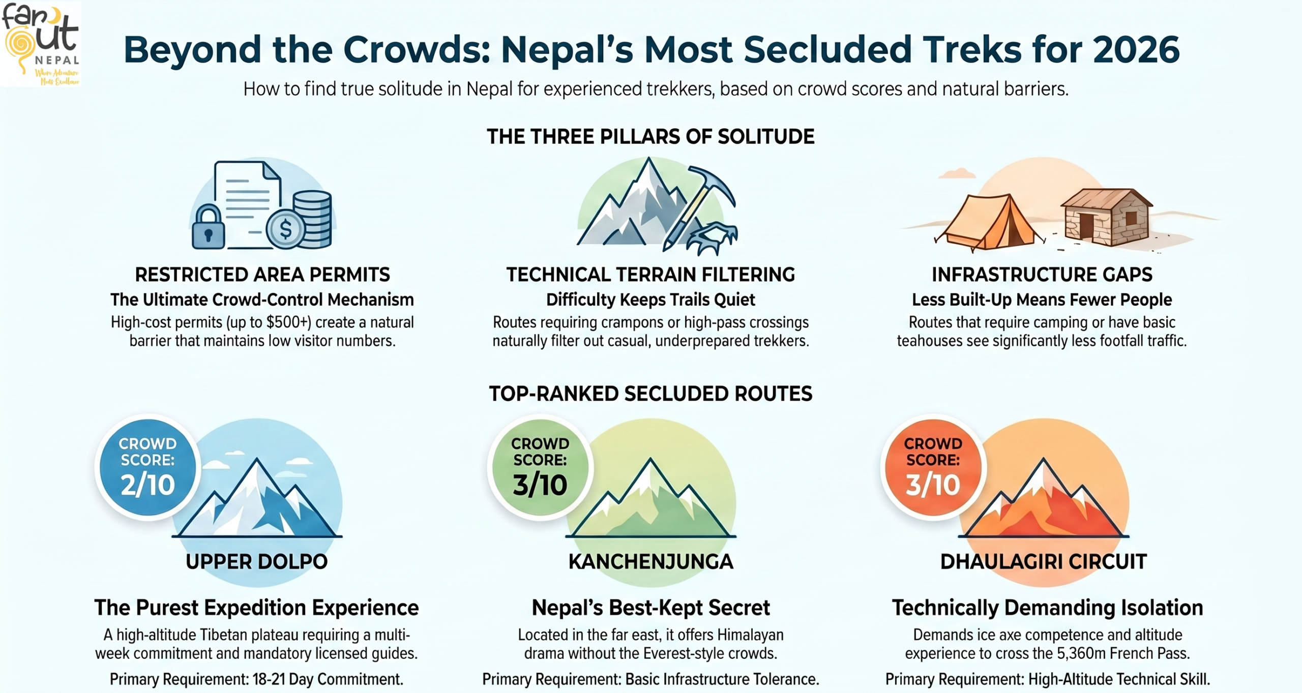
7 Less Crowded Treks in Nepal in 2026 (Ranked by Actual Crowd Experience)
Crowd Score is rated 1–10. Lower = quieter. Based on ground experience, permit data, and seasonal observation.
1. Upper Dolpo Trek
Crowd Score: 2/10
Best season for solitude: June–September (post-monsoon window), October
Upper Dolpo is in a category of its own. The restricted area permit (which is one of the most expensive in Nepal) keeps annual visitor numbers genuinely low. Large sections of the route are camping-only because teahouse infrastructure simply doesn’t exist. The landscape is a high-altitude Tibetan plateau: barren, ancient, and unlike anything else in Nepal.
Why it’s still quiet: The permit cost, the remoteness, the multi-week commitment, and the logistical complexity combine to create a natural filter. This isn’t a trek you stumble into. The people who do Dolpo have researched it for years.
Reality check: This is a serious undertaking. Minimum 18–21 days, camping sections, high passes, and very limited bailout options. A licensed guide is not optional, but legally required and genuinely necessary.
Who it’s for: Experienced trekkers with high-altitude experience and a tolerance for genuine remoteness, and time. Not a beginner’s trek by any means. Possibly the purest expedition trek experience.
2. Kanchenjunga Trek
Crowd Score: 3/10
Best season for solitude: April–May, October–November
Nepal’s far east is the country’s best-kept trekking secret. Kanchenjunga (the world’s third-highest peak) sees a fraction of the attention that Everest and Annapurna receive, despite offering comparable Himalayan drama. The approach from Taplejung is long, the infrastructure is basic by Nepal standards, and that combination keeps casual trekkers away.
Why it’s still quiet: It requires a flight or a long drive to Taplejung just to start. There’s no short version. The trek to both north and south base camps takes 3+ weeks, and overlaps with other popular routes is zero.
Reality check: Basic teahouses, variable food options, and a genuine sense of being far from help if something goes wrong. That last part is not meant to discourage; this is what makes it extraordinary.
Who it’s for: Trekkers who’ve done the classic routes and want something that shows Nepal in its rawest form.
3. Dhaulagiri Trek
Crowd Score: 3/10
Best season for solitude: October, April–May
One of our signature routes at Far Out Nepal, and one we’re genuinely proud to offer. The Dhaulagiri circuit via French Pass and Hidden Valley is technically demanding. But it’s also precisely why it stays quiet. The crowd self-selects out early.
Why it’s still quiet: French Pass (5,360m) and the Hidden Valley section require crampons, ice axe competence, and altitude experience. Most Nepal trekkers are not equipped or prepared for this level of terrain. It’s not considered a technical route to just sound fancy. It genuinely is.
Reality check: This trek routinely catches people off guard with its technical demands. You should be highly prepared to embark on this journey. The rewards of a near-private view of Dhaulagiri’s south face, the surreal Hidden Valley, and almost no other trekkers are proportional to the effort.
Who it’s for: Experienced trekkers with some high-altitude and winter terrain experience. People who read route descriptions carefully and aren’t prone to overestimating their fitness level.
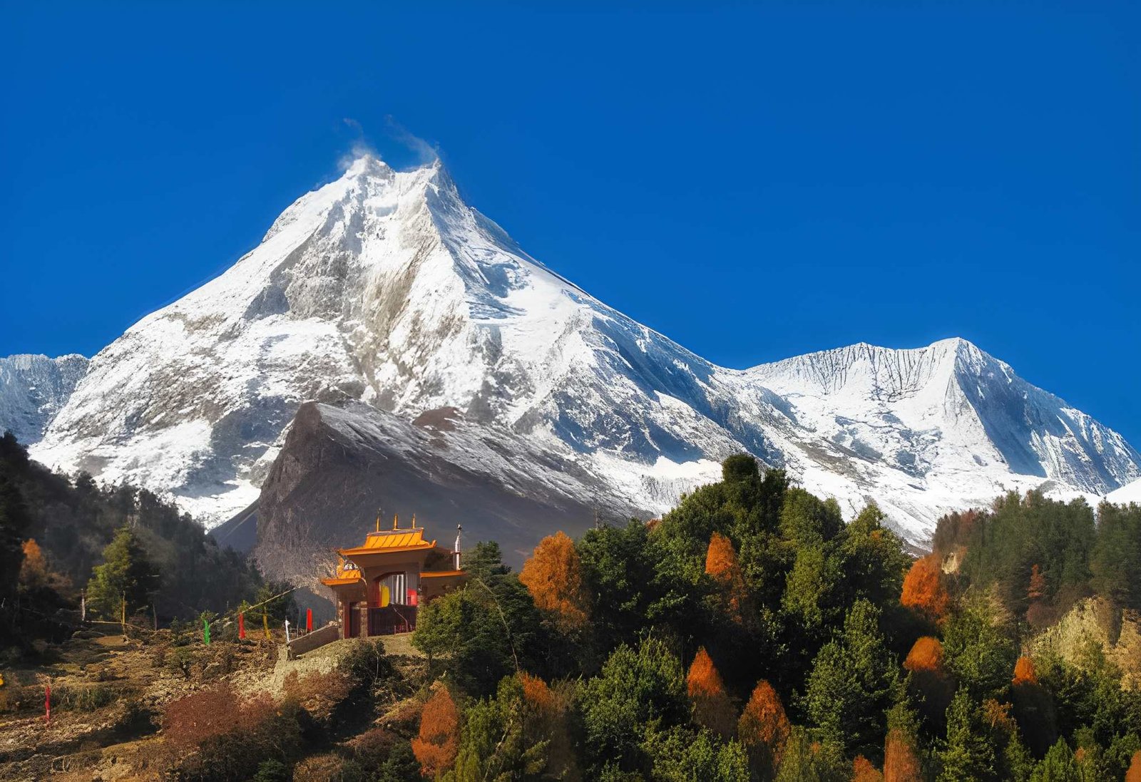
4. Manaslu Circuit Trek
Crowd Score: 4/10
Best season for solitude: November, early April
The honest assessment: Manaslu is growing. It is no longer the secret it was five years ago, and October now sees real traffic through certain sections. But it still registers significantly quieter than Annapurna Circuit or the Everest region, and the restricted area permit requirement maintains some natural filtering.
Why it’s still relatively quiet: The permit and mandatory guide requirement and the distance from Kathmandu add enough friction to keep it off the itinerary for shorter trips. The Larkya La pass (5,106m) also requires a level of preparation that filters out underprepared trekkers.
Reality check: If you’re doing this in October, particularly around the Samagaon to Samdo section, you will encounter other trekkers. It’s not the Annapurna Circuit crowded, but it has managed to meet solitude expectations. Go in November for a noticeably quieter experience.
Who it’s for: Trekkers ready to step up from the classic routes but not yet ready for the full commitment of Dolpo or Kanchenjunga, which is a genuinely rewarding middle ground.
5. Upper Mustang Trek
Crowd Score: 4/10
Best season for solitude: June–August (the monsoon bypass)
Upper Mustang sits in a rain shadow north of the Annapurna massif. This makes it one of the few Nepal treks that’s actually better in the monsoon months, when everywhere else is soaked and quiet-seekers are still looking for options.
The restricted area permit (now $50/day following a November 2025 policy change) still maintains a cost barrier, though easier access means crowd levels may gradually increase in the coming years.
Why it’s still quiet: The permit cost keeps casual visitors away. The landscape of the high-altitude Tibetan desert, ancient cave monasteries, and the walled city of Lo Manthang draws a specific kind of traveler rather than mass tourism.
Reality check: Infrastructure has genuinely improved in recent years. This is no longer a camping-only route. But “improved” is relative as expectations need to be calibrated to a remote Himalayan context, not a Kathmandu hotel.
Who it’s for: Trekkers interested in Tibetan Buddhist culture as much as mountain scenery. Anyone looking for a genuinely unique landscape that looks nothing like the rest of Nepal.
6. Everest Three Pass/Gokyo Trek
Crowd Score: 5/10
Best season for solitude: November, early May
Here’s a counterintuitive one: The Everest region itself, done differently. The Three Pass Trek of Cho La, Renjo La, and Kongma La shares the Everest approach as far as Namche Bazaar, then diverges sharply from the EBC highway. Most trekkers on the Everest trail are going to base camp and back. The passes filter them out by difficulty alone.
Why it’s still relatively quiet: Cho La Pass (5,420m) and the technical terrain around the three passes deters a large portion of EBC trekkers who are doing it as a bucket list item rather than a serious mountain experience. After Namche, the crowd thins significantly.
Reality check: You will share Namche, Tengboche, and Dingboche with EBC trekkers. You need to be ready for that. Above Dingboche and around the Gokyo Valley, the experience changes completely.
Who it’s for: Everest region enthusiasts who want the landscapes without the highway. Also suitable for trekkers who’ve completed the EBC and wish to return to the region via a different route.
7. Langtang Ganja La Trek
Crowd Score: 6/10
Best season for solitude: October–November, March
The distinction matters here. The standard Langtang Valley trek is no longer a quiet route. The Ganja La variation, which involves crossing the 5,122m Ganja La Pass into the Helambu region, is a fundamentally different experience. The pass creates a technical barrier that separates the casual Langtang visitor from the serious trekker.
Why it’s still relatively quiet: Ganja La requires a rope and an experienced guide for safe crossing. Most trekkers on the Langtang trail don’t attempt it. That one pass changes the entire crowd profile of the route.
Reality check: It has the highest score on this list for a reason. You will share the lower Langtang sections with standard route trekkers. The quieter experience begins at and beyond the pass itself.
Who it’s for: Trekkers with solid Nepal experience looking for a challenging variation on a familiar region. Good acclimatization profile for those building toward bigger objectives.
Which Less Crowded Trek Is Actually Right for You?
The list above covers a wide spectrum. Here’s how to filter it honestly.
If you want quiet but not remote, start with the Manaslu Circuit or the Everest Three Pass. Permit barriers do meaningful crowd-filtering, infrastructure is reasonable, and you’re not committing to a 3-week camping expedition. These are the accessible end of “less crowded.”
If you want genuinely off-beaten-path, Kanchenjunga or Dhaulagiri. Commit to 18–21 days, come with solid fitness and altitude experience, and accept that a guide is non-negotiable on both. The payoff is a Nepal that most trekkers never see.
If you want true expedition-level isolation, Upper Dolpo. This is the far end of the spectrum. Restricted permits, camping sections, and genuine remoteness. Not for everyone. That’s exactly the point.
Not sure which fits your actual experience level? We’ve been matching trekkers to the right routes for 25 years. Tell us where you’ve trekked before and what you’re looking for, and we’ll give you a straight answer→
A Note on Logistics: What Remote Treks Actually Require
A few realities worth knowing before you book anything on this list.
Restricted area permits: Dolpo, Mustang, Manaslu, and the Kanchenjunga area all require special permits beyond the standard TIMS and national park fees. These range from $90 to $500+, depending on the area and duration. Budget for them.
Guide requirements: Several of these treks legally require a licensed guide. Beyond legality, for routes like Dhaulagiri and Dolpo, a guide isn’t a luxury, but the difference between a safe trek and a serious incident. The terrain and isolation demand it.
Infrastructure expectations: “less crowded” often means “less built up.” Teahouse quality varies significantly on remote routes. Camping sections exist in Dolpo and parts of Kanchenjunga. If your comfort threshold requires guaranteed hot showers and Wi-Fi, calibrate expectations accordingly.
Cost reality: Remote treks cost more. Porters, permits, guide logistics, and longer duration all contribute. A Dolpo expedition costs significantly more than an EBC package. That’s not operator markup. It’s the genuine cost of reaching and supporting a journey in one of the world’s most remote regions.
Beyond Nepal: Himalayan Alternatives in Bhutan and Tibet
If you’ve read this far and the common narrative is “I want the Himalayas without the crowds” rather than “I specifically want Nepal,” two alternatives are worth knowing about.
Bhutan operates on a high-value, low-volume tourism model by government policy. The daily tourist fee structure limits mass tourism by design, which means trails and cultural sites that would be overwhelmed elsewhere remain genuinely accessible. Tiger Nest Hike and Snowman Trek offer Himalayan scenery with a crowd profile that Nepal’s open-access routes simply can’t match.
Tibet offers high-altitude landscapes and Tibetan Buddhist culture in a context that feels entirely distinct from anything in Nepal. The regulatory environment means visitor numbers are controlled, and overland routes through Central Tibet to Kailash offer a Himalayan experience of a different order entirely.
We run carefully designed small-group itineraries to both. If your interest extends beyond Nepal’s borders, our Bhutan and Tibet pages have the details.
Planning a Less Crowded Trek: Where to Start
The treks on this list are not plug-and-play packages. The permit systems, logistical complexity, and genuine remoteness of these routes require real planning, not a last-minute booking.
We’ve been running these specific routes for over two decades. Not just listing them. That distinction matters when something goes wrong at 5,000 meters, and the nearest road is four days away.
If one of these treks caught your attention, reach out with a quick inquiry. Tell us which route, your trekking background, and your timeframe. We’ll come back with a realistic breakdown: What it costs, what it requires, and whether it’s the right fit for where you are as a trekker.
How Hard Is The Gokyo Lakes Trek for Trekkers?
Is the Gokyo Lakes Trek Difficult?
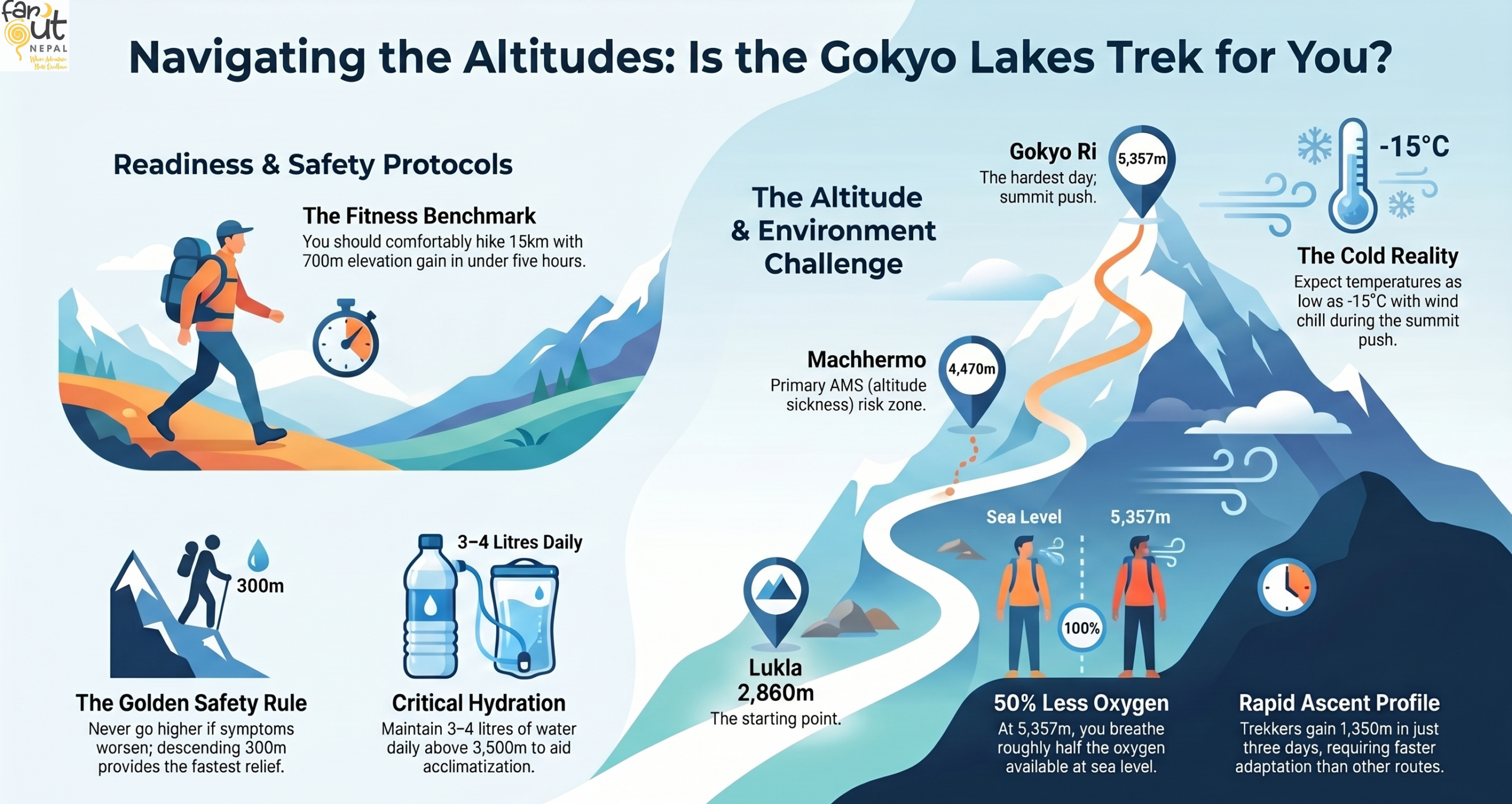
The Gokyo Lakes trek is moderately difficult. It’s not that the trails are technical, but because altitude is relentless. You will reach over 5,000m, and at that elevation, even a simple walk demands more from your body than you might expect. Trekkers with reasonable fitness and proper acclimatisation complete it successfully every season.
At a glance:
- The main challenge is altitude, not terrain. There are no ropes, ladders, or scrambling on the standard route
- Gokyo Ri summit (5,357m) is the hardest single day, requiring an early pre-dawn start
- Expect 5–7 hours of trekking per day on established trails through forest, alpine meadow, and glacial moraine
- Nights in Gokyo drop below freezing even in peak season
- Adding the Cho La Pass raises the difficulty to strenuous and introduces genuine technical terrain
- Best suited for trekkers with prior multi-day hiking experience
Wandering about the itineraries and logistics? Browse the main page: Gokyo Lakes and EBC via Gokyo→.
What Makes the Gokyo Lakes Trek Difficult?
Every year, thousands of trekkers reach Gokyo, and a meaningful number turn around before they get there. The reason is rarely the trails. It is the altitude. Understanding why this actually makes this trek hard will tell you more about your readiness than any difficulty label.
High Altitude and Acclimatisation
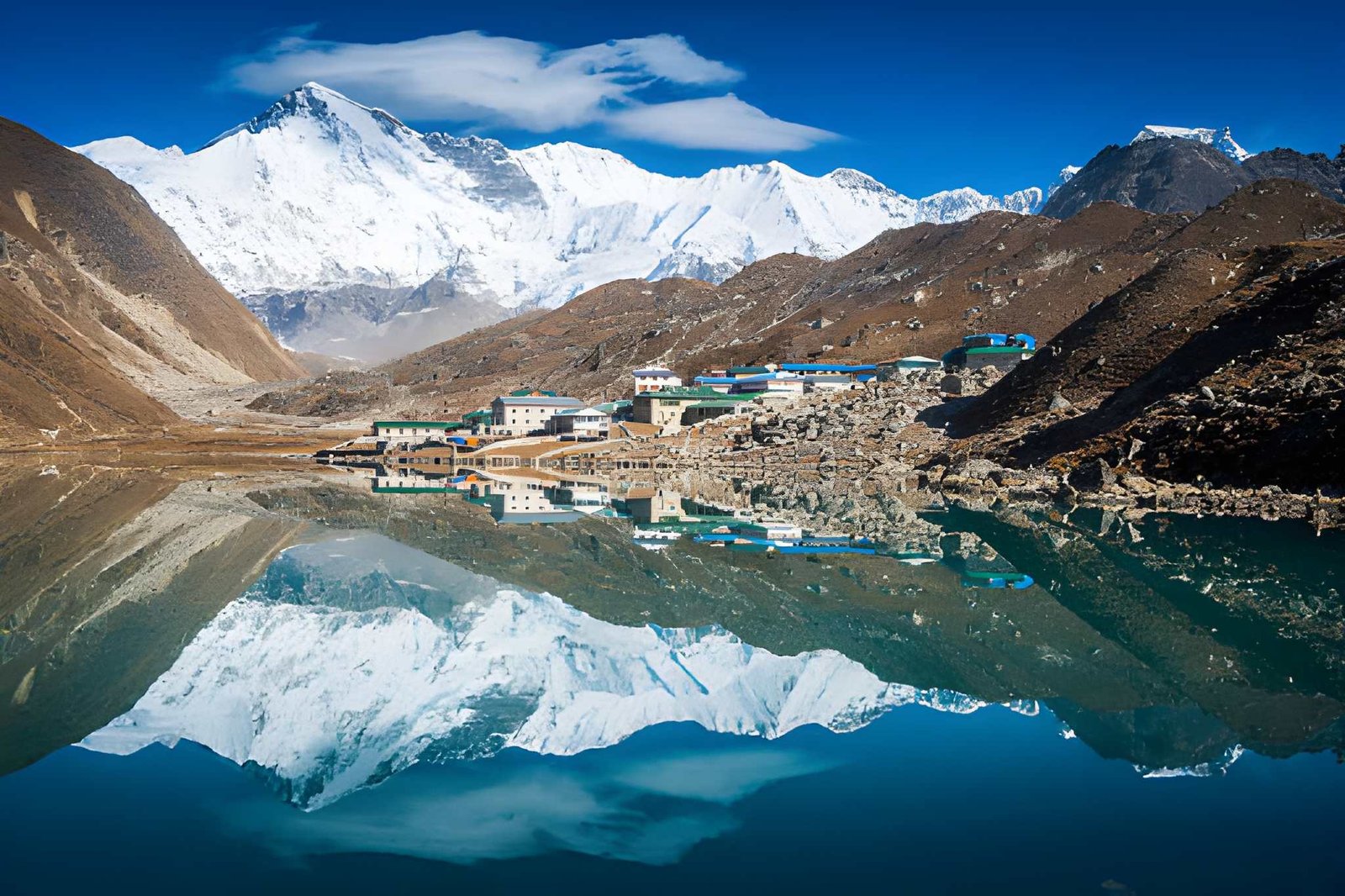
The Gokyo Lakes sit at 4,790m above sea level. Gokyo Ri, the viewpoint peak above the lakes, reaches 5,357m. At these elevations, you are breathing air that contains roughly 52–54% of the oxygen available at sea level, about half of what your lungs are used to.
That number sounds abstract until you feel it. A short walk to the teahouse bathroom leaves you slightly breathless. Your resting heart rate runs 15–20 beats higher than normal. Sleep is shallow and often interrupted. None of these indicates that something has gone wrong. It is simply how the human body responds when oxygen is scarce.
You also need to understand that from Namche Bazaar (3,440m), you reach Gokyo (4,790m) in roughly three days, gaining 1,350m in a very short window. This is a faster ascent profile than the classic Everest Base Camp route, which stages more gradually through Tengboche and Dingboche. Your body has less time to adapt.
This is why the acclimatisation day in Namche is non-negotiable, and why Machhermo (4,470m) is often where altitude sickness first announces itself.
Know the signs: Above Dole (4,038m), watch for persistent headache, loss of appetite, nausea, and disrupted sleep. These are early AMS signals, and resting should be prioritised.
The golden rule: Never go higher if you feel worse. Descending 300–500m brings faster relief than any medication.
Elevation profile of the standard Gokyo route:
| Checkpoint | Altitude | Notes |
| Lukla | 2,860m | Start |
| Namche Bazaar | 3,440m | Acclimatization stop |
| Dole | 4,038m | Watch for early symptoms |
| Machhermo | 4,470m | AMS risk zone |
| Gokyo Lakes | 4,790m | Base for Gokyo Ri |
| Gokyo Ri | 5,357m | Summit day |
Trekking Duration and Daily Distance
The standalone Gokyo Lakes trek covers around 100–110km over 12–14 days, including acclimatisation days.
On active trekking days, you walk 5–7 hours, covering 10–16km depending on the stage. Distance is a poor measure of effort here. A 10km day across glacial moraine at 4,700m is far harder than a 14km day on the forest trail below Namche.
Cumulative fatigue is real. By day eight or nine, your legs carry tiredness from every previous day. Trekkers who pace themselves conservatively in the lower sections consistently find the higher stages more manageable.
Terrain and Trail Conditions
The Gokyo route is not technically difficult, but it moves through four distinct terrain zones:
- Forest and lower valley (Lukla → Namche, 2,800–3,440m): Well-maintained stone-paved trail with a steep initial descent from Lukla, then a sustained 600m climb through pine and rhododendron forest. Suspension bridges over the Dudh Koshi gorge are narrow but solid.
- Alpine meadow (Namche → Machhermo, 3,440–4,470m): Open, exposed ridgeline walking with wide trails and sweeping views. Wind exposure increases noticeably. This is where altitude begins affecting your breathing on uphills. Steady pacing matters more than pace itself.
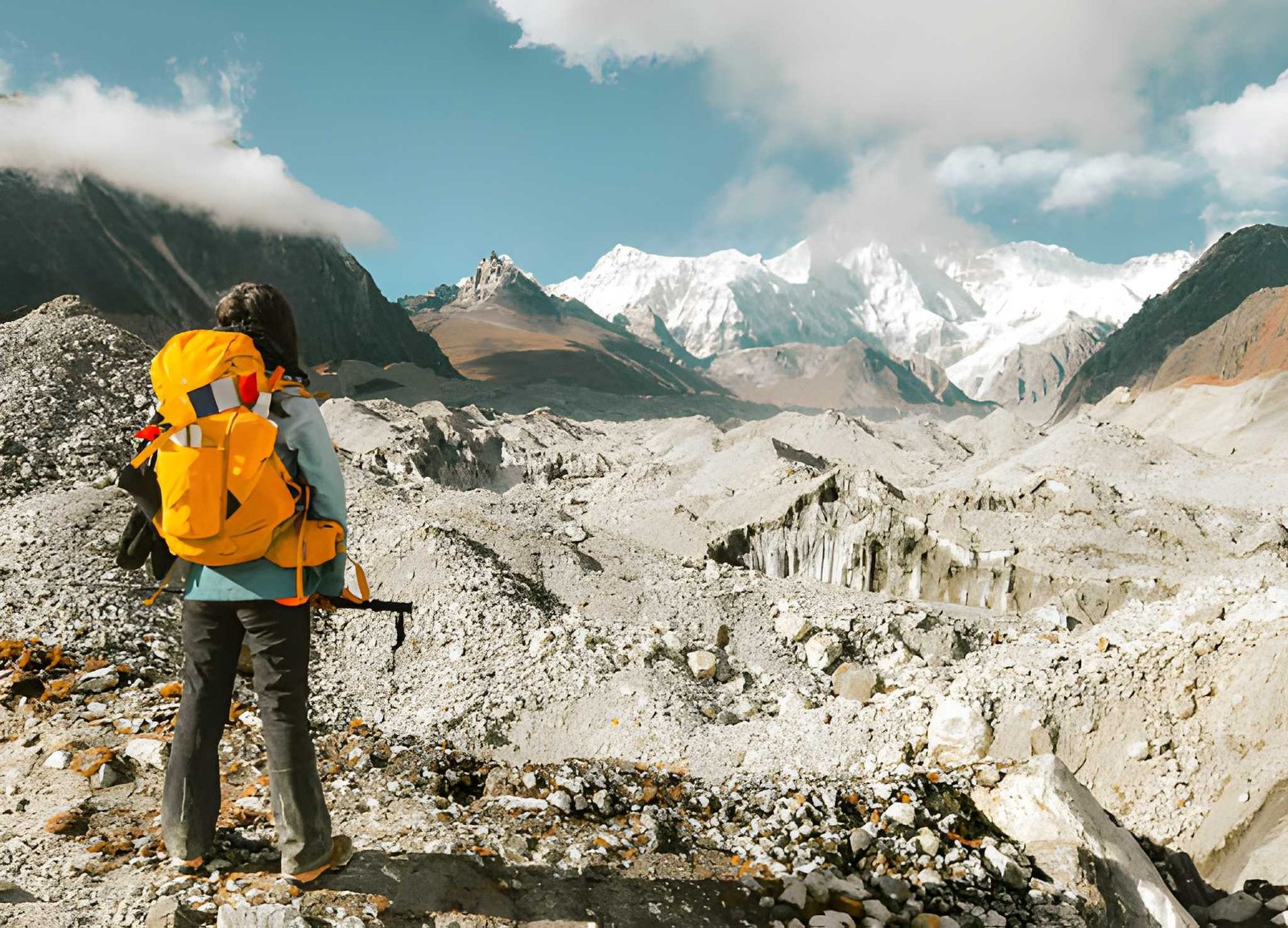
- Glacial moraine (Gokyo valley, 4,470–4,790m): The trail changes character significantly here. Walking across the rocky debris deposited by the Ngozumpa Glacier demands ankle stability and constant attention to footing. Rocks shift underfoot. Trail marking is less consistent. Trekking poles earn their place here.
- High-altitude summit (Gokyo Ri, 4,790–5,357m): Steep, loose, and unrelenting. Roughly 560m of vertical gain in about two hours. No technical equipment required, but mental resilience matters as much as physical fitness at this altitude.
Weather and Cold Conditions
The Gokyo Valley sits in a high mountain bowl that funnels wind and traps cold air. In peak season, daytime temperatures at the village run between 0°C and 10°C in sunshine. After dark, they drop to -10°C or colder. On Gokyo Ri before sunrise, expect -15°C with wind chill.
Afternoon cloud cover arrives reliably from mid-morning onward (target a pre-dawn summit). The weather can shift from clear to whiteout within two hours. Building contingency days into your schedule is sound planning, not pessimism.
Best seasons: Mid-October to November for clearest skies and stable weather. Mid-March through April for warmer conditions and rhododendron on the lower trails. Avoid monsoon (June–September) and deep winter (December–February).
Gokyo Ri Ascent: The Hardest Day
The Gokyo Ri summit push is the day that separates well-prepared trekkers from underprepared ones. The summit sits at 5,357m, roughly 560m above the village where you sleep the night before. The distance (3–4km) tells you almost nothing about the effort.
Most trekkers leave by 5:00–5:30 am to summit at sunrise before cloud builds. That means starting in darkness and cold, on legs already tired from several hard days. The gradient is steep and continuous, with no comfortable mid-section to recover your breathing. At 5,200m, your pace will be roughly a third of what it is at sea level for the same physical output. That is physiology, not weakness.
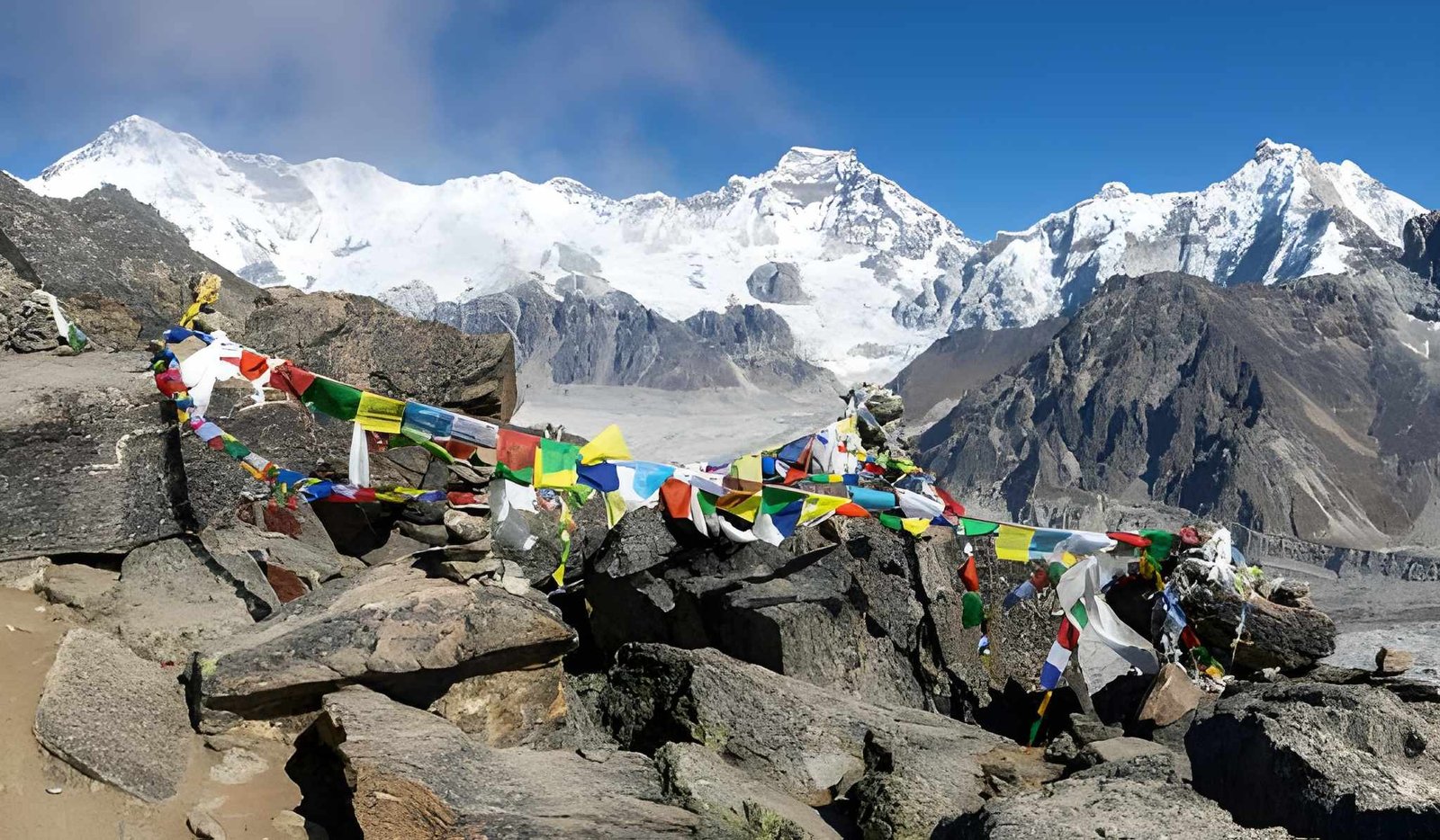
The reward is a 360° panorama of Everest, Cho Oyu, Lhotse, and Makalu rising above the Ngozumpa Glacier and the turquoise lakes below. For many trekkers, this is the finest mountain viewpoint in the Himalayas.
Cho La Pass: When the Trek Turns Technical
The Cho La Pass (5,420m) is not part of the standard Gokyo Lakes trek. It is an optional crossing connecting the Gokyo Valley to the Khumbu region, done by trekkers extending their route toward Everest Base Camp. The standard Gokyo route has no technical terrain, but Cho La changes the difficulty category entirely.
The 5-7 hours crossing involves glacier travel with potential ice and snow, loose scree, and a steep descent requiring careful footing. Crampons are sometimes necessary.
Who should skip Cho La: First-time high-altitude trekkers; anyone who experienced significant AMS symptoms on the approach to Gokyo; solo trekkers without a guide; anyone travelling between December and February.
Safe season window: Mid-October through November and late March through May. The pass can close without warning after snowfall at any time of year. So, check conditions with local guides the evening before.
Difficulty Level Explained: Who Is This Trek For?
The “moderately difficult” label is accurate but incomplete.
So, can Beginners Do the Gokyo Lakes Trek?
If you have never hiked a multi-day trail before, Gokyo is not the right starting point. Altitude magnifies every physical weakness you may have, and managing your body across multiple consecutive hard days requires experience.
If you have done multi-day hikes, are generally active, and are willing to invest in genuine preparation, the Gokyo Lakes route (without Cho La) is achievable. The critical factor is not just fitness, but the mental framework to pace yourself. Listen to your body at altitude, and choose rest over pushing.
Not suitable as a first trek for: Anyone who has never hiked with a loaded pack over multiple days; anyone with untreated cardiovascular conditions; anyone planning to complete it in under 12 days without prior altitude experience.
Required Fitness Level
The trek rewards aerobic endurance above raw strength.
The benchmark: If you can comfortably complete a 15km hike with 700m of elevation gain in under 5 hours, you have the base fitness required. Comfortably means finishing tired but not spent. If it takes everything you have, train for another six weeks first.
Cardiorespiratory fitness matters most above Namche. Trekkers who smoke, have asthma, or have any respiratory history should consult a doctor before departure.
Difficulty Scale: Where Do You Fit?
| Trekker Profile | Experience | Gokyo Suitability |
| First-time trekker | No multi-day hiking; new to altitude | Not recommended without significant prep. Consider the Everest Panorama Trek first. |
| Prepared beginner | Some multi-day hiking, 3–4 months specific training; never above 3,000m | Achievable on standard route with careful acclimatisation and 13–14 day schedule. Skip Cho La. Use a guide. |
| Intermediate trekker | Multi-day experience; comfortable at 6+ hours/day; some altitude exposure | Ideal. Challenging and rewarding without being overwhelming. Cho La is worth considering if the approach to Gokyo feels manageable. |
| Experienced trekker | Previous Himalayan trekking, above 4,000m before | Comfortable. Many combine Gokyo with EBC on the full circular route. |
Gokyo Lakes vs Everest Base Camp: Which Is Harder?
Neither is dramatically harder, but they are different kinds of difficult. EBC reaches a marginally higher maximum (5,545m at Kala Patthar vs 5,357m at Gokyo Ri) with a more gradual ascent profile, giving your body slightly more time to adapt. The Gokyo approach gains altitude faster from Namche, demanding quicker acclimatisation.
Without Cho La, the two routes sit at comparable overall difficulty. With Cho La, Gokyo is clearly the harder undertaking.
See our full Gokyo vs EBC route comparison → for a clear breakdown across scenery, crowds, and best-fit trekker profiles.
How to Make the Gokyo Trek Easier
Acclimatization Tips
Treat acclimatisation days as the trek working correctly, not as downtime. The two non-negotiable stops: two nights in Namche (with a day hike to 3,800m+ on the rest day) and one rest day at Machhermo or Gokyo before attempting Gokyo Ri.
Aim for 3–4 litres of water per day above 3,500m, while avoiding alcohol. Diamox (acetazolamide) is used by some trekkers as a prophylactic; consult your doctor before departure.
Training Before the Trek
Start at least 10–12 weeks before departure. The most effective training is also the most obvious: walk uphill with a loaded pack, repeatedly. Gym fitness helps but does not substitute for trail-specific endurance.
You can check out our “Training For the EBC Trek” to get a complete preparation guide for the Himalayas.
Packing for High Altitude
Target a daypack of 7–9kg; your main bag with a porter under 15kg. Non-negotiables: a down jacket rated to -15°C, a sleeping bag rated to -10°C minimum (teahouse blankets above Namche are unreliable), waterproof layers, and adjustable trekking poles with carbide tips. Carry altitude medication, blister care, and electrolytes. Everything else is negotiable.
Final Thoughts
The Gokyo Lakes trek is hard. That is part of its value. But “hard” means sustained effort at altitude across multiple days. No technical climbing, no life-threatening terrain, nothing that genuine preparation cannot overcome.
What it asks of you is honesty: about your fitness, your timeline, and your willingness to prepare in the months before you go. Trekkers who take that preparation seriously have a profoundly different experience from those who do not.
If Gokyo has been on your list, the question is not is this too hard for me? It is am I willing to prepare properly? If the answer is yes, the lakes are waiting.
Ready to plan your trek? Browse our Everest Via Gokyo package today.